National Geographic
Colorado Trail Collegiate Loop: Map #1203
Colorado Trail Collegiate Loop: Map #1203
Couldn't load pickup availability
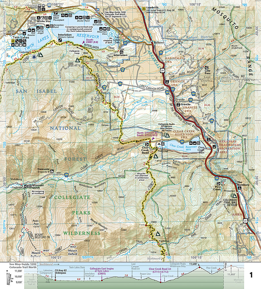
National Geographic Trails Illustrated Colorado Trail Collegiate Loop Map #1203 — waterproof, tear-resistant. Dedicated coverage of the 160-mile Collegiate Loop connecting the Colorado Trail with the Collegiate Peaks Wilderness in central Colorado. GPS-compatible.
The National Geographic Trails Illustrated Colorado Trail Collegiate Loop Map provides dedicated coverage of the 160-mile Collegiate Loop — a challenging circuit connecting the Colorado Trail with the Collegiate Peaks Wilderness around the Harvard, Columbia, Yale, and Oxford 14er group. Loop route, elevation profiles, water sources, resupply points, campsite locations, and GPS coordinates are mapped in detail.
Key specs
- SKU: NGTI1203
- Map number: 1203
- Coverage: Colorado Trail Collegiate Loop, central Colorado
- Material: Waterproof, tear-resistant paper
- Features: Full loop route, elevation profiles, water sources, resupply points, campsite locations, GPS coordinates
Why it works
The Collegiate Loop is one of Colorado's premier long-distance backpacking routes, circumnavigating the Collegiate Peaks with over 22,000 feet of elevation gain — a dedicated loop map with elevation profiles and resupply detail goes far beyond what standard topographic maps provide for planning this multi-week trip. The loop's complexity and the high-altitude terrain require accurate route and water source mapping for safe completion. Waterproof construction survives the Sawatch Range's afternoon thunderstorms.
Ideal for
Thru-hikers and backpackers completing the Colorado Trail Collegiate Loop around the Collegiate Peaks. See also NGTI148 (Collegiate Peaks Wilderness) for detailed topographic coverage of the wilderness area.
Share