National Geographic
The Pocono Mountains Destination Touring Map
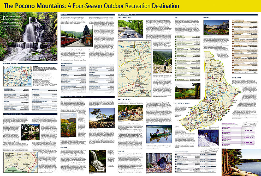
The Pocono Mountains Destination Touring Map
Couldn't load pickup availability
National Geographic Pocono Mountains Destination Touring Map — waterproof, tear-resistant, detailed topography and trail networks, ski areas, lakes, scenic drives, and backroads. Folded 4" x 8.75".
The National Geographic Pocono Mountains Destination Touring Map covers Pennsylvania's Pocono region with detailed topography, hiking and trail networks, ski areas, lakes, rivers, scenic drives, and backroads. Designed for year-round outdoor recreation and weekend getaways in the Poconos.
Key specs
- SKU: NGDM010
- Coverage: Pocono Mountains, Pennsylvania
- Folded size: 4" x 8.75"
- Material: Waterproof, tear-resistant synthetic paper
Why it works
The Pocono Mountains' mix of ski resorts, state forests, lakes, and resort communities is spread across a large area of northeastern Pennsylvania where backroads and secondary routes are essential for reaching the best destinations. Standard road maps don't include the trail, ski area, and lake access detail that outdoor visitors need. Waterproof construction survives Pennsylvania's four-season weather from winter snow to summer rain.
Ideal for
Outdoor enthusiasts, skiers, hikers, and weekend getaway travelers exploring the Pocono Mountains. See also NGGM054 (Pennsylvania Road Map) for broader statewide coverage.
Share