National Geographic
South Platte River Map Bundle
South Platte River Map Bundle
Couldn't load pickup availability
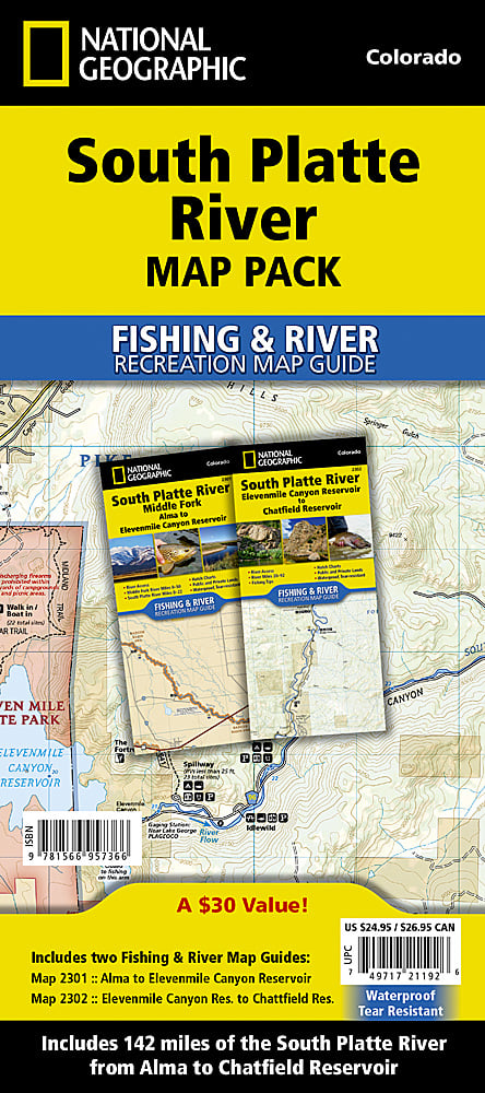
Two-map bundle covering the South Platte River from the Middle Fork to Chatfield Reservoir — waterproof, tear-resistant. Includes maps 2301 and 2302.
The National Geographic South Platte River Fishing Map Bundle includes both South Platte River map sections — Middle Fork (NGFR2301) and Elevenmile to Chatfield (NGFR2302) — giving you complete coverage of Colorado's most popular Front Range Gold Medal fishery. Fishing access easements, regulations, campgrounds, trails, and public land boundaries on waterproof, tear-resistant paper.
Bundle includes:
- NGFR2301: South Platte River, Middle Fork (Pike National Forest)
- NGFR2302: South Platte River, Elevenmile to Chatfield (Cheesman Canyon, Deckers, Waterton Canyon)
Key specs (each map):
- SKU: NGFR002
- Scale: 1" = ½ mile
- Folded size: 4.25" x 9.38"
- Material: Waterproof, tear-resistant paper with stainless steel staples
- Full UTM grid for GPS navigation
- Weight: ~3.2 oz per map
Why it works:
The South Platte is Colorado's most accessible Gold Medal fishery for Front Range anglers, but the complex patchwork of public easements, private land, and special regulation water across both sections requires accurate, detailed mapping. Having both map sections in one purchase means you can fish the full river corridor — from the Middle Fork through Cheesman Canyon and Deckers to Waterton Canyon — without gaps in coverage.
Ideal for: Fly fishers and anglers targeting the South Platte's Gold Medal water from the Middle Fork to Chatfield Reservoir near Denver.
Share