National Geographic
South Platte River, Elevenmile-Chatfield: Map #2302
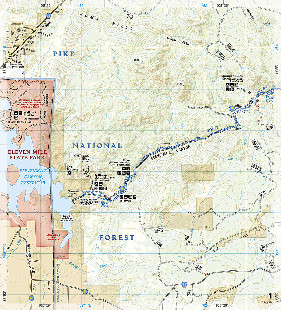
South Platte River, Elevenmile-Chatfield: Map #2302
Couldn't load pickup availability
Waterproof fishing and river recreation map of the South Platte River from Elevenmile Reservoir to Chatfield Reservoir — Gold Medal fishing, access easements, and public lands.
The National Geographic Fishing & River Map 2302 covers the South Platte River from Elevenmile Reservoir through Cheesman Canyon, Deckers, and Waterton Canyon to Chatfield Reservoir — Colorado's most heavily fished Gold Medal trout corridor near Denver. Fishing access easements, regulations, campgrounds, trails, and public land boundaries on waterproof, tear-resistant paper with a full UTM grid for GPS navigation.
Coverage includes:
- South Platte River from Elevenmile Reservoir to Chatfield Reservoir
- Cheesman Canyon, Deckers, and Waterton Canyon sections
- Gold Medal fishing water and public access easements
- Fishing regulations and special regulation water
- Campgrounds, trails, and recreation areas
- Public vs. private land boundaries
Key specs:
- SKU: NGFR2302
- Scale: 1" = ½ mile
- Folded size: 4.25" x 9.38"
- Material: Waterproof, tear-resistant paper with stainless steel staples
- Full UTM grid for GPS navigation
- Weight: ~3.2 oz
Why it works:
The South Platte from Elevenmile to Chatfield is Colorado's most accessible Gold Medal fishery for Front Range anglers, but navigating the complex patchwork of public easements, private land, and special regulation water requires accurate, detailed mapping. This map clearly shows where you can legally fish and access the river — essential information for productive, legal fishing on the South Platte.
Ideal for: Fly fishers and anglers targeting the South Platte's Gold Medal water near Denver. See also NGFR2301 for the Middle Fork section and NGFR002 for the full South Platte bundle.
Share