National Geographic
Adventure Map: Sicily
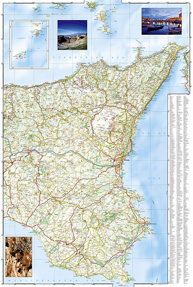
Adventure Map: Sicily
Couldn't load pickup availability
Waterproof, tear-resistant adventure map of Sicily — topography, roads, trails, Mount Etna, Greek temples, and points of interest.
The National Geographic Adventure Map of Sicily (3310) covers the island including Mount Etna, the Valley of the Temples, Palermo, Syracuse, the Aeolian Islands, and the full road network with accurate topography and points of interest. Printed on waterproof, tear-resistant synthetic paper.
Key specs:
- SKU: NGAM3310
- Material: Waterproof, tear-resistant synthetic paper
- Folded size: 4.25" x 9.25"
- Open size: 26" x 38"
- Two-sided print with comprehensive place name index
Why it works:
Sicily is Italy's largest island with extraordinary geographic and cultural diversity — Europe's most active volcano, some of the best-preserved Greek temples outside Greece, Baroque hill towns, and dramatic coastlines. This map covers the full island with the road and terrain detail needed for road trips, hiking on Etna, and exploring Sicily's archaeological sites and interior.
Ideal for: Road trippers, hikers, history enthusiasts, and adventure travelers exploring Sicily's Mount Etna, Greek temples, Baroque towns, and coastlines.
Share