National Geographic
Black Hills National Forest Northeast: Map #751
Black Hills National Forest Northeast: Map #751
Couldn't load pickup availability
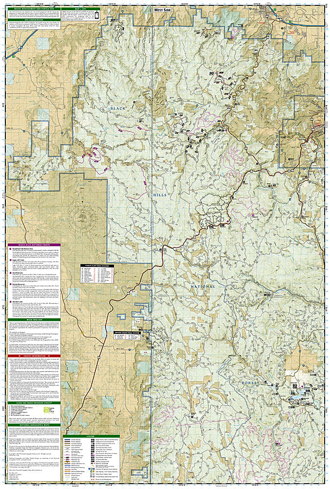
National Geographic Trails Illustrated Black Hills National Forest Northeast Map #751 — waterproof, tear-resistant. Coverage of the northeastern Black Hills National Forest including Spearfish Canyon, Deadwood, and the Mickelson Trail in South Dakota. GPS-compatible.
The National Geographic Trails Illustrated Black Hills National Forest Northeast Map covers the northeastern Black Hills — Spearfish Canyon Scenic Byway, Deadwood, the Mickelson Trail, and surrounding Black Hills National Forest. Trails, OHV routes, scenic byways, campgrounds, and GPS coordinates are mapped in detail.
Key specs
- SKU: NGTI751
- Map number: 751
- Coverage: Black Hills National Forest Northeast, South Dakota
- Material: Waterproof, tear-resistant paper
- Features: Trails, Spearfish Canyon, Mickelson Trail, OHV routes, Deadwood, campgrounds, GPS coordinates
Why it works
Spearfish Canyon is one of the most scenic drives in the Black Hills, with waterfalls and limestone cliffs that attract visitors year-round — detailed trail and access point mapping is essential for visitors who want to explore beyond the scenic byway. The Mickelson Trail's 109-mile rail-trail route requires accurate trailhead and access point detail for planning multi-day cycling trips. Waterproof construction survives the Black Hills' variable weather from summer thunderstorms to early-season snow.
Ideal for
OHV riders, cyclists, hikers, and history enthusiasts exploring the northeastern Black Hills, Spearfish Canyon, and Deadwood in South Dakota. See also NGTI238 (Black Hills National Forest South) for southern coverage.
Share