National Geographic
Adventure Map: Scotland
Adventure Map: Scotland
Couldn't load pickup availability
Waterproof, tear-resistant adventure map of Scotland — topography, roads, trails, Highlands, national parks, and points of interest.
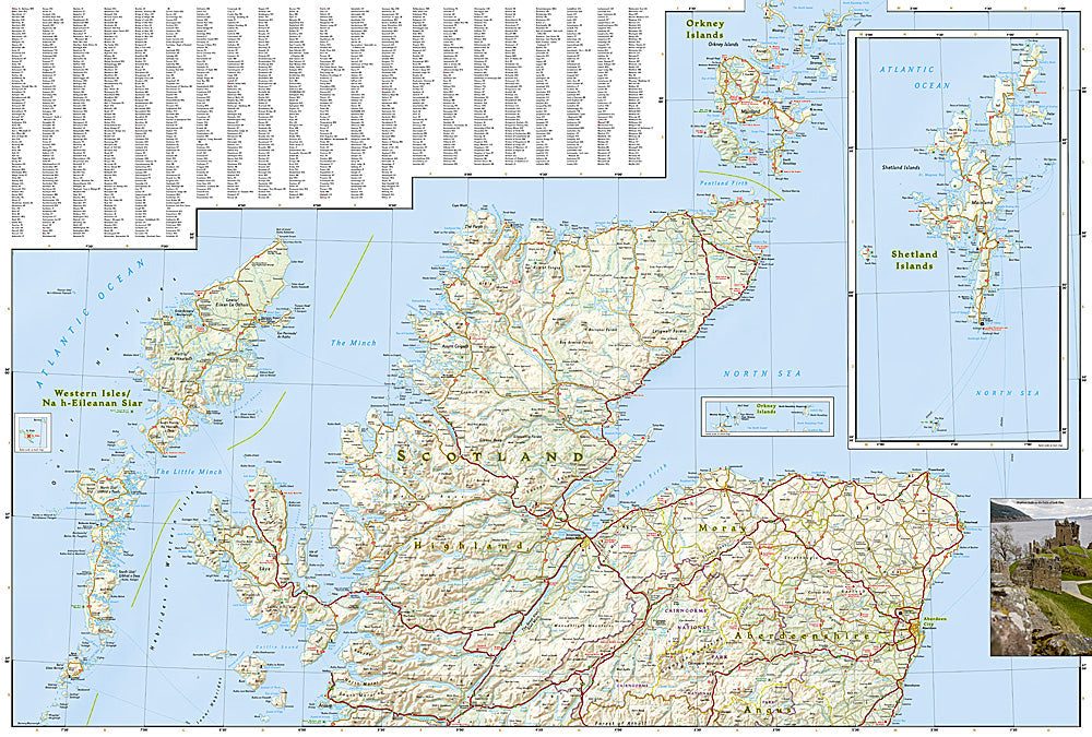
The National Geographic Adventure Map of Scotland (3326) covers the Scottish Highlands, Islands, Lowlands, and Borders with accurate topography, road networks, national parks, long-distance trails, and points of interest. The West Highland Way, Cape Wrath Trail, Cairngorms, and Isle of Skye are all covered. Printed on waterproof, tear-resistant synthetic paper.
Key specs:
- SKU: NGAM3326
- Material: Waterproof, tear-resistant synthetic paper
- Folded size: 4.25" x 9.25"
- Open size: 26" x 38"
- Two-sided print with comprehensive place name index
Why it works:
Scotland's Highlands and Islands offer some of Britain's most dramatic and remote landscapes — the West Highland Way, Cape Wrath Trail, Cairngorms National Park, and the Hebridean islands all reward travelers who can navigate beyond the main roads. Waterproof construction is essential in Scotland's notoriously wet and changeable weather.
Ideal for: Hikers on the West Highland Way and Cape Wrath Trail, road trippers, and adventure travelers exploring Scotland's Highlands, Islands, and national parks.
Share