National Geographic
Roaring Fork & Fryingpan Rivers: Map & Guide
Roaring Fork & Fryingpan Rivers: Map & Guide
Couldn't load pickup availability
Waterproof fishing and river recreation map of the Roaring Fork and Fryingpan Rivers, Colorado — Gold Medal fishing water, access points, hatch charts, and public lands.
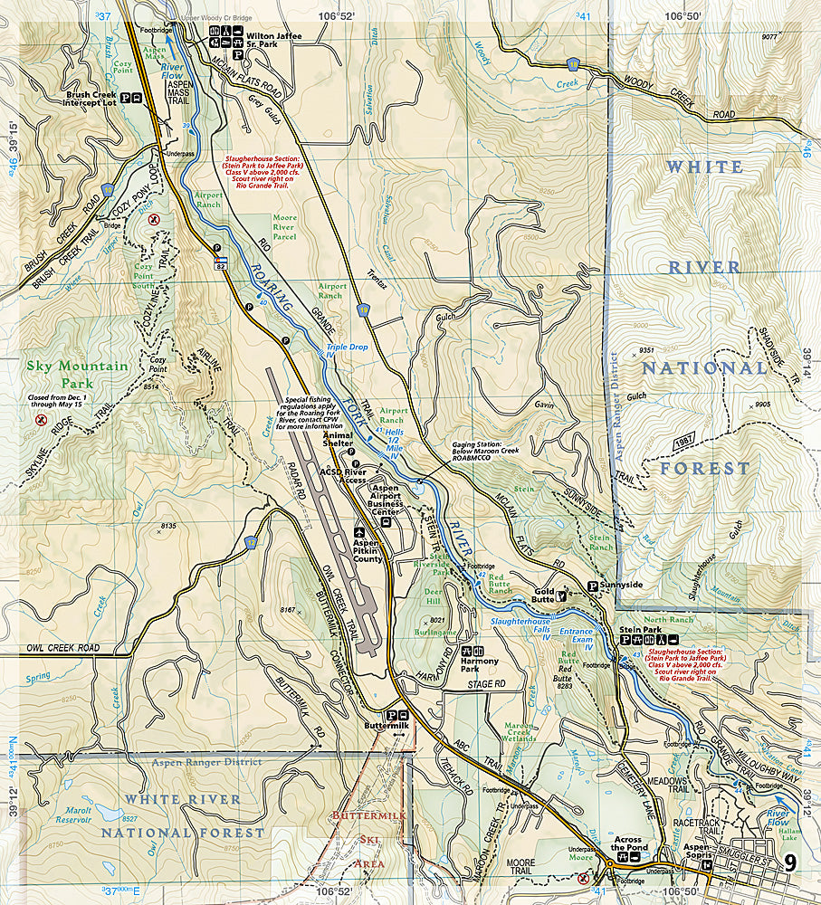
The National Geographic Fishing & River Map 2305 covers the Roaring Fork River from Aspen to Glenwood Springs and the Fryingpan River from Ruedi Reservoir to its confluence with the Roaring Fork — two of Colorado's most celebrated Gold Medal trout fisheries. Fishing access points, public easements, hatch charts, fishing regulations, campgrounds, and public land boundaries on waterproof, tear-resistant paper with a full UTM grid for GPS navigation.
Coverage includes:
- Roaring Fork River from Aspen to Glenwood Springs
- Fryingpan River from Ruedi Reservoir to Roaring Fork confluence
- Gold Medal fishing water and public access easements
- Hatch charts and fishing regulation information
- Campgrounds, put-ins, take-outs, and recreation sites
- Public vs. private land boundaries
Key specs:
- SKU: NGFR2305
- Scale: 1" = ½ mile
- Folded size: 4.25" x 9.38"
- Material: Waterproof, tear-resistant paper with stainless steel staples
- Full UTM grid for GPS navigation
- Weight: ~3.2 oz
Why it works:
The Fryingpan is one of Colorado's most productive tailwaters, and the Roaring Fork through Basalt and Carbondale offers exceptional public access to Gold Medal water. Knowing exactly where public easements begin and end — and what hatches to expect — is essential for productive fishing on these heavily fished rivers. This map provides that detail in a waterproof format that survives streamside use.
Ideal for: Fly fishers targeting the Roaring Fork and Fryingpan Rivers' Gold Medal trout water near Aspen and Basalt, Colorado.
Share