National Geographic
Adventure Map: Pyrenees & Andorra
Adventure Map: Pyrenees & Andorra
Couldn't load pickup availability
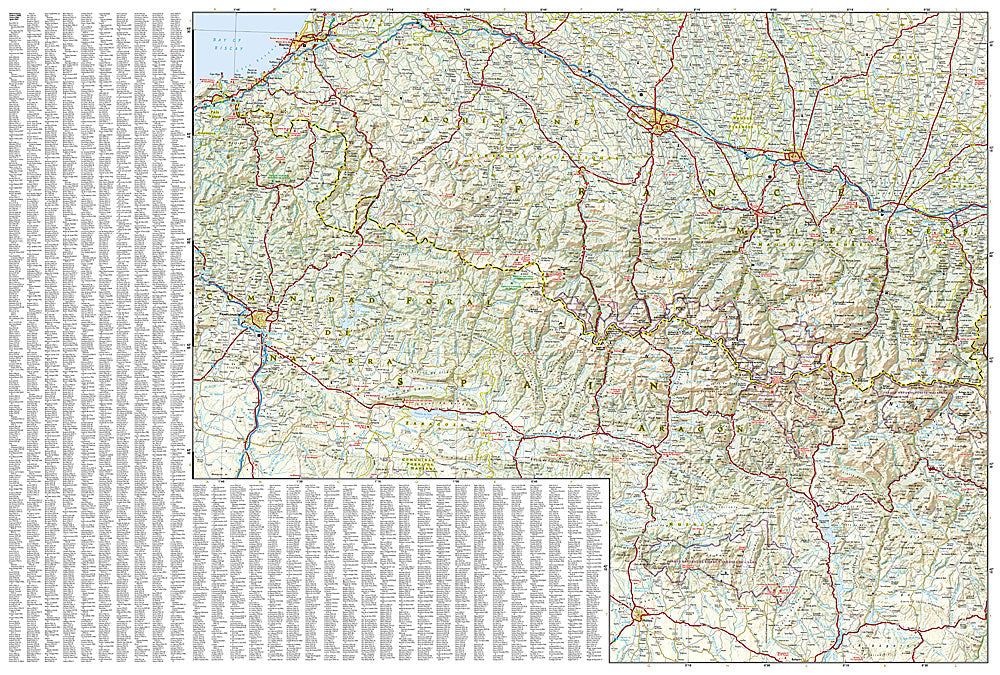
Waterproof, tear-resistant adventure map of the Pyrenees & Andorra — topography, roads, trails, GR10/GR11, national parks, and points of interest.
The National Geographic Adventure Map of the Pyrenees & Andorra (3308) covers the full Pyrenean mountain range from the Atlantic to the Mediterranean, including the GR10 (French side), GR11 (Spanish side), Haute Route Pyrénéenne, Ordesa National Park, and Andorra with accurate topography, trail networks, and points of interest. Printed on waterproof, tear-resistant synthetic paper.
Key specs:
- SKU: NGAM3308
- Material: Waterproof, tear-resistant synthetic paper
- Folded size: 4.25" x 9.25"
- Open size: 26" x 38"
- Two-sided print with comprehensive place name index
Why it works:
The Pyrenees offer some of Europe's finest mountain trekking — the GR10 and GR11 traverse the full range on the French and Spanish sides respectively, while the Haute Route crosses the highest terrain. This map covers the full range with the trail and terrain detail needed for multi-day trekking, day hiking, and road trips through the Pyrenean passes.
Ideal for: Trekkers on the GR10, GR11, and Haute Route, hikers, and road trippers exploring the Pyrenees and Andorra.
Share