National Geographic
Pennsylvania Recreation Atlas
Pennsylvania Recreation Atlas
Couldn't load pickup availability
Comprehensive recreation atlas for Pennsylvania — detailed road maps, public lands, parks, forests, game lands, and outdoor recreation information statewide.
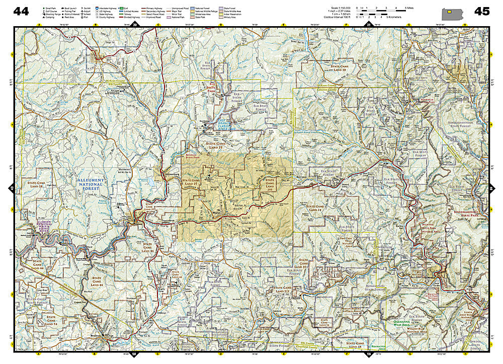
The National Geographic Pennsylvania Recreation Atlas provides the most detailed statewide mapping available for Pennsylvania's backroads, public lands, and outdoor recreation destinations. From the Poconos and Pocono Mountains to the Allegheny National Forest and Laurel Highlands, every county is covered with accurate road networks, state game lands, state forests, state parks, and recreation sites.
What's inside:
- Detailed county-by-county road maps covering all of Pennsylvania
- State game lands, state forests, and state parks clearly marked
- Public land boundaries for hunting, fishing, and recreation access
- Backroads, forest roads, and secondary road networks
- Recreation sites: campgrounds, boat launches, trailheads, and fishing access
- GPS-compatible grid with UTM coordinates
- Sturdy spiral binding for flat, easy field use
Key specs:
- SKU: NGRA056
- Publisher: National Geographic / Benchmark Maps
- Format: Spiral-bound atlas
- Coverage: Full state of Pennsylvania
Why it works:
Pennsylvania has over 2.2 million acres of state game lands and 2.1 million acres of state forest — more public land than most eastern states. Navigating this complex patchwork of public and private land requires detailed, accurate mapping that goes well beyond a standard road map. This atlas provides the county-level detail needed for hunting, fishing, hiking, and backcountry exploration across the Keystone State.
Ideal for: Hunters, anglers, hikers, road trippers, and outdoor enthusiasts exploring Pennsylvania's public lands, state forests, and game lands.
Share