National Geographic
Allegheny National Forest South: Map #739
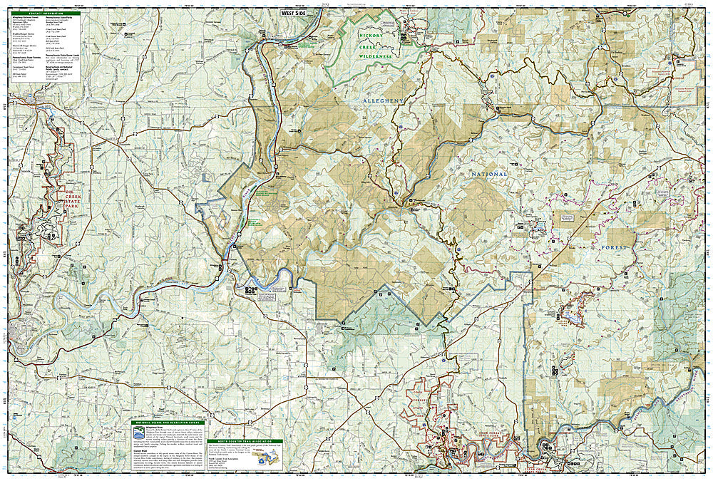
Allegheny National Forest South: Map #739
Couldn't load pickup availability
National Geographic Trails Illustrated Allegheny National Forest South Map #739 — waterproof, tear-resistant. Coverage of the southern Allegheny National Forest including the Clarion River, Hickory Creek Wilderness, and surrounding forest trails in Pennsylvania. GPS-compatible.
The National Geographic Trails Illustrated Allegheny National Forest South Map covers the southern section of the Allegheny National Forest in Pennsylvania — the Clarion Wild & Scenic River, Hickory Creek Wilderness, and surrounding hardwood forest trails. Trails, river access, equestrian routes, campgrounds, and GPS coordinates are mapped in detail.
Key specs
- SKU: NGTI739
- Map number: 739
- Coverage: Allegheny National Forest South, Pennsylvania
- Material: Waterproof, tear-resistant paper
- Features: Trails, Clarion River, Hickory Creek Wilderness, equestrian routes, campgrounds, GPS coordinates
Why it works
The Clarion River is one of Pennsylvania's designated Wild & Scenic Rivers, offering flatwater paddling and fishing through the Allegheny National Forest — detailed river access and campsite mapping is essential for planning multi-day float trips. The Hickory Creek Wilderness's old-growth forest and trail network require accurate mapping for navigation. Waterproof construction survives the frequent rain common in Pennsylvania's Allegheny Plateau.
Ideal for
Paddlers, hikers, equestrians, and campers exploring the southern Allegheny National Forest and Clarion River in Pennsylvania. See also NGTI738 (Allegheny National Forest North) for the northern section.
Share