National Geographic
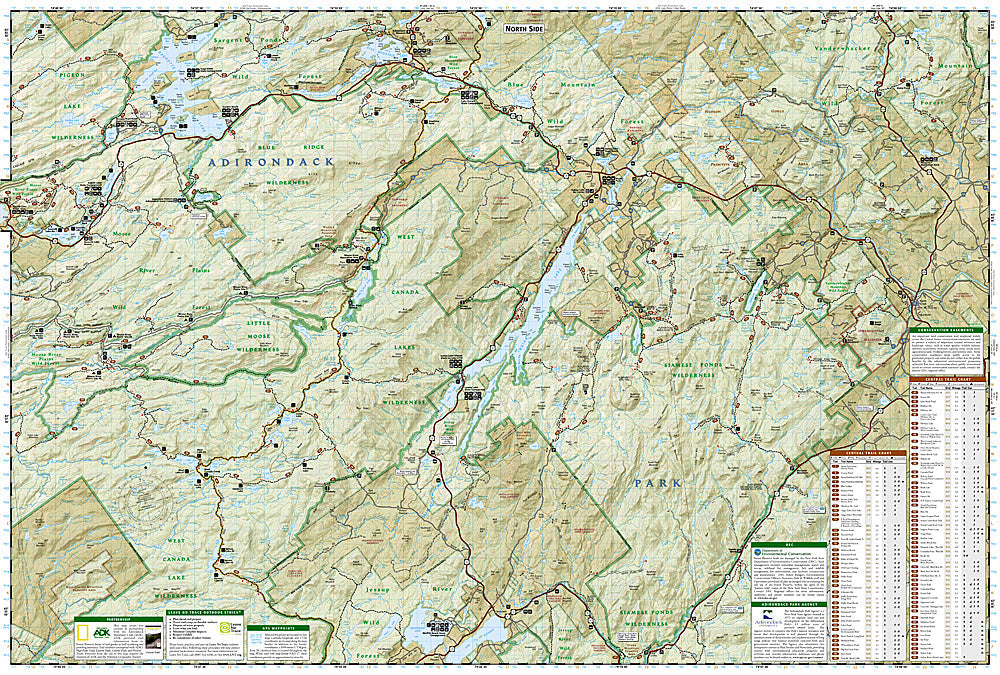
Northville, Raquette Lake: Map #744
Northville, Raquette Lake: Map #744
Couldn't load pickup availability
National Geographic Trails Illustrated Northville & Raquette Lake Map #744 — waterproof, tear-resistant. Coverage of the central Adirondack Park including the Northville-Placid Trail corridor, Raquette Lake, and surrounding wilderness canoe routes in New York. GPS-compatible.
The National Geographic Trails Illustrated Northville & Raquette Lake Map covers the central Adirondack Park — the Northville-Placid Trail corridor through this section, Raquette Lake, the Fulton Chain of Lakes, and surrounding wilderness canoe routes. Hiking trails, canoe routes, lean-tos, campgrounds, and GPS coordinates are mapped in detail.
Key specs
- SKU: NGTI744
- Map number: 744
- Coverage: Northville & Raquette Lake area, Adirondack Park, New York
- Material: Waterproof, tear-resistant paper
- Features: NPT corridor, canoe routes, Raquette Lake, lean-tos, campgrounds, GPS coordinates
Why it works
The central Adirondacks around Raquette Lake and the Fulton Chain offer a combination of long-distance hiking on the Northville-Placid Trail and classic Adirondack canoe camping on the interconnected lake and river system — a map covering both activities in one sheet is essential for visitors planning multi-day trips. The canoe route network requires accurate portage and campsite detail for planning. Waterproof construction survives the Adirondacks' frequent rain and the lake environment.
Ideal for
Backpackers, paddlers, and Adirondack explorers hiking the NPT or paddling the canoe routes around Raquette Lake. See also NGTI736 (Northville-Placid Trail) for the complete NPT route and NGTIB022 (Adirondack Park Bundle) for full park coverage.
Share