National Geographic
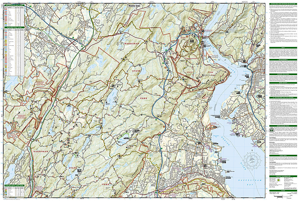
Harriman, Bear Mountain: Map #756
Harriman, Bear Mountain: Map #756
Couldn't load pickup availability
National Geographic Trails Illustrated Harriman & Bear Mountain Map #756 — waterproof, tear-resistant. Coverage of Harriman State Park, Bear Mountain State Park, the Appalachian Trail corridor, and the Long Path in New York's Hudson Highlands. GPS-compatible.
The National Geographic Trails Illustrated Harriman & Bear Mountain Map covers the Hudson Highlands park complex — Harriman State Park (one of the largest state parks in the US), Bear Mountain State Park, the Appalachian Trail corridor, the Long Path, and surrounding Hudson Valley terrain. Trails, AT route, shelters, lakes, and GPS coordinates are mapped in detail.
Key specs
- SKU: NGTI756
- Map number: 756
- Coverage: Harriman & Bear Mountain State Parks, New York (Hudson Highlands)
- Material: Waterproof, tear-resistant paper
- Features: Trails, AT corridor, Long Path, shelters, lakes, GPS coordinates
Why it works
Harriman State Park's 200+ miles of trails form one of the most complex trail networks in the northeastern US, located within an hour of New York City — accurate trail junction and shelter mapping is essential for navigating the park's dense network safely. The AT's passage through Harriman and Bear Mountain is one of the most heavily used sections of the entire trail. Waterproof construction survives the Hudson Highlands' frequent rain and the variable weather common in the New York highlands year-round.
Ideal for
Day hikers, backpackers, AT section hikers, and New York City-area outdoor enthusiasts exploring Harriman and Bear Mountain State Parks. See also NGTI1508 (AT NJ/NY) for the full AT corridor coverage.
Share