National Geographic
Presidential Ridge, Gorham: Map #741
Presidential Ridge, Gorham: Map #741
Couldn't load pickup availability
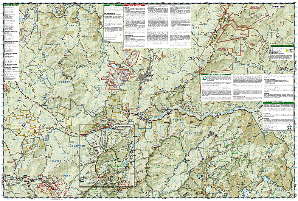
National Geographic Trails Illustrated Presidential Ridge & Gorham Map #741 — waterproof, tear-resistant. Coverage of the Presidential Range, Mount Washington, the AMC hut system, and surrounding White Mountain National Forest in New Hampshire. GPS-compatible.
The National Geographic Trails Illustrated Presidential Ridge & Gorham Map covers the Presidential Range of New Hampshire's White Mountains — Mount Washington (6,288 ft, highest peak in the Northeast), the Presidential Traverse, the AMC hut system, the Appalachian Trail corridor, and surrounding White Mountain National Forest. Trails, AT route, AMC huts, above-treeline terrain, and GPS coordinates are mapped in detail.
Key specs
- SKU: NGTI741
- Map number: 741
- Coverage: Presidential Range & Gorham area, White Mountain National Forest, New Hampshire
- Material: Waterproof, tear-resistant paper
- Features: Trails, Presidential Traverse, Mount Washington, AMC huts, AT corridor, above-treeline routes, GPS coordinates
Why it works
Mount Washington has the highest wind speed ever recorded on Earth's surface and weather that can turn life-threatening within minutes — accurate above-treeline route and emergency shelter (AMC hut) location mapping is essential for safe navigation on the Presidential Range. The Presidential Traverse is one of the most demanding day hikes in the eastern US, requiring detailed trail and terrain mapping. Waterproof construction is critical on the Presidentials where rain, wind, and icing can occur in any month of the year.
Ideal for
Serious hikers, mountaineers, AT section hikers, and AMC hut-to-hut travelers exploring the Presidential Range and Mount Washington in New Hampshire. See also NGTI740 (Franconia Notch & North Conway) for adjacent coverage.
Share