National Geographic
New York Finger Lakes Destination Touring Map
New York Finger Lakes Destination Touring Map
Couldn't load pickup availability
National Geographic New York Finger Lakes Destination Touring Map — waterproof, tear-resistant, detailed regional maps of all 11 lakes, wineries, parks, hiking trails, and scenic routes. Folded 4" x 8.75".
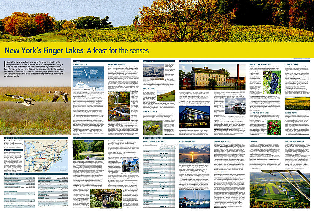
The National Geographic New York Finger Lakes Destination Touring Map covers all 11 Finger Lakes with wineries, state parks, waterfalls, gorges, hiking trails, and scenic routes mapped throughout. Designed for road trips, wine touring, and outdoor exploration across this distinctive Upstate New York region.
Key specs
- SKU: NGDM007
- Coverage: New York Finger Lakes region
- Folded size: 4" x 8.75"
- Material: Waterproof, tear-resistant synthetic paper
Why it works
The Finger Lakes region's 11 lakes, hundreds of wineries, and network of state parks and gorges are spread across a large area where a regional map is essential for planning efficient routes between destinations. The winery and park detail goes well beyond what a standard road map provides, making this the right tool for wine touring and outdoor exploration in the region. Waterproof construction handles the rain common in Upstate New York.
Ideal for
Wine tourists, nature lovers, and road trippers exploring the New York Finger Lakes region's lakes, wineries, waterfalls, and state parks. See also NGGM042 (New York State Road Map) for broader statewide coverage.
Share