National Geographic
Old Forge & Oswegatchie: Map #745
Old Forge & Oswegatchie: Map #745
Couldn't load pickup availability
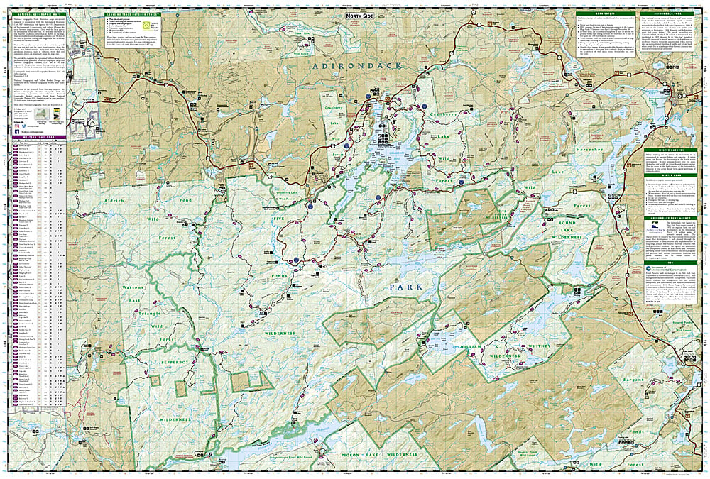
National Geographic Trails Illustrated Old Forge & Oswegatchie Map #745 — waterproof, tear-resistant, scale 1:75,000. Coverage of the Old Forge and Oswegatchie regions of Adirondack Park including the Five Ponds Wilderness, Pigeon Lake Wilderness, and surrounding canoe routes in New York. GPS-compatible.
The National Geographic Trails Illustrated Old Forge & Oswegatchie Map covers the western Adirondack Park — the Five Ponds Wilderness, Pigeon Lake Wilderness, the Oswegatchie River canoe route, Fulton Chain of Lakes, and surrounding wilderness terrain. Hiking trails, canoe routes, lean-tos, campgrounds, and GPS coordinates are mapped in detail.
Key specs
- SKU: NGTI745
- Map number: 745
- Scale: 1:75,000
- Coverage: Old Forge & Oswegatchie area, Adirondack Park, New York
- Material: Waterproof, tear-resistant paper
- Features: Trails, canoe routes, Five Ponds Wilderness, Oswegatchie River, lean-tos, GPS coordinates
Why it works
The Oswegatchie River canoe route through the Five Ponds Wilderness is one of the most remote and classic wilderness paddling trips in the Adirondacks, requiring detailed river and portage mapping for multi-day trips deep into the wilderness interior. The Fulton Chain of Lakes provides accessible paddling and camping for less experienced visitors. Waterproof construction survives the Adirondacks' frequent rain and the lake and river environment.
Ideal for
Paddlers, backpackers, and Adirondack wilderness lovers exploring the Old Forge area, Five Ponds Wilderness, and Oswegatchie River canoe route. See also NGTI744 (Northville & Raquette Lake) for adjacent coverage to the east.
Share