National Geographic
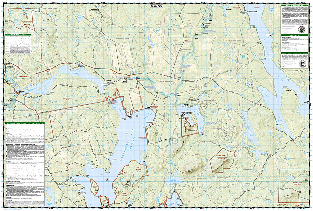
Allagash Wilderness Waterway South: Map #401
Allagash Wilderness Waterway South: Map #401
Couldn't load pickup availability
National Geographic Trails Illustrated Allagash Wilderness Waterway South Map #401 — waterproof, tear-resistant. Coverage of the southern section of the Allagash Wilderness Waterway including Chamberlain Lake, Eagle Lake, and surrounding Maine wilderness. GPS-compatible.
The National Geographic Trails Illustrated Allagash Wilderness Waterway South Map covers the southern entry section of Maine's Allagash Wilderness Waterway — Chamberlain Lake, Eagle Lake, Churchill Lake, and the upper waterway corridor through the north Maine woods. Paddling routes, portages, campsites, ranger stations, and GPS coordinates are mapped in detail.
Key specs
- SKU: NGTI401
- Map number: 401
- Coverage: Allagash Wilderness Waterway South, Maine
- Material: Waterproof, tear-resistant paper
- Features: Paddling routes, portages, Chamberlain & Eagle Lakes, campsites, ranger stations, GPS coordinates
Why it works
The southern Allagash Wilderness Waterway's chain of large lakes — Chamberlain, Eagle, and Churchill — requires accurate lake navigation and portage mapping for safe multi-day canoe trips in this remote Maine wilderness. The waterway's permit system and designated campsite locations make accurate campsite mapping essential for compliant visits. Waterproof construction is essential in a lake and river environment where maps are constantly exposed to water.
Ideal for
Canoeists, kayakers, and wilderness campers paddling the southern Allagash Wilderness Waterway in Maine. See also NGTI400 (Allagash Wilderness Waterway North) for the northern section.
Share