National Geographic
Adventure Map: Ireland
Adventure Map: Ireland
Couldn't load pickup availability
Waterproof, tear-resistant adventure map of Ireland — topography, roads, trails, Wild Atlantic Way, national parks, and points of interest.
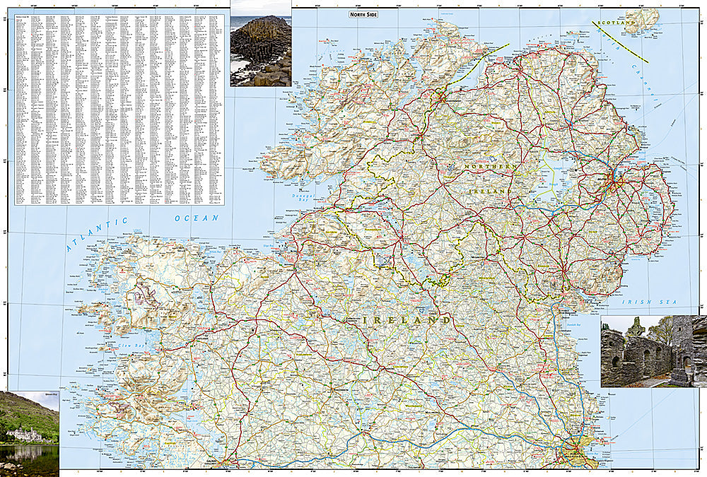
The National Geographic Adventure Map of Ireland (3303) covers the Republic of Ireland and Northern Ireland with accurate topography, road networks, national parks, Wild Atlantic Way, and points of interest. Connemara, the Burren, Ring of Kerry, Wicklow Mountains, and the Causeway Coast are all covered. Printed on waterproof, tear-resistant synthetic paper.
Key specs:
- SKU: NGAM3303
- Material: Waterproof, tear-resistant synthetic paper
- Folded size: 4.25" x 9.25"
- Open size: 26" x 38"
- Two-sided print with comprehensive place name index
Why it works:
Ireland's Wild Atlantic Way stretches 2,500 km along the western coast — one of the world's great coastal drives. The island also has exceptional hiking in Connemara, the Wicklow Mountains, and the Burren, plus the Giant's Causeway in Northern Ireland. This map covers the full island with the road and trail detail needed for road trips and hiking in all weather — waterproof construction is essential in Ireland's famously wet climate.
Ideal for: Road trippers, hikers, cyclists, and adventure travelers exploring Ireland's Wild Atlantic Way, national parks, and coastal scenery.
Share