National Geographic
Adventure Map: Iceland
Adventure Map: Iceland
Couldn't load pickup availability
Waterproof, tear-resistant adventure map of Iceland — topography, roads, trails, Ring Road, volcanoes, glaciers, and points of interest.
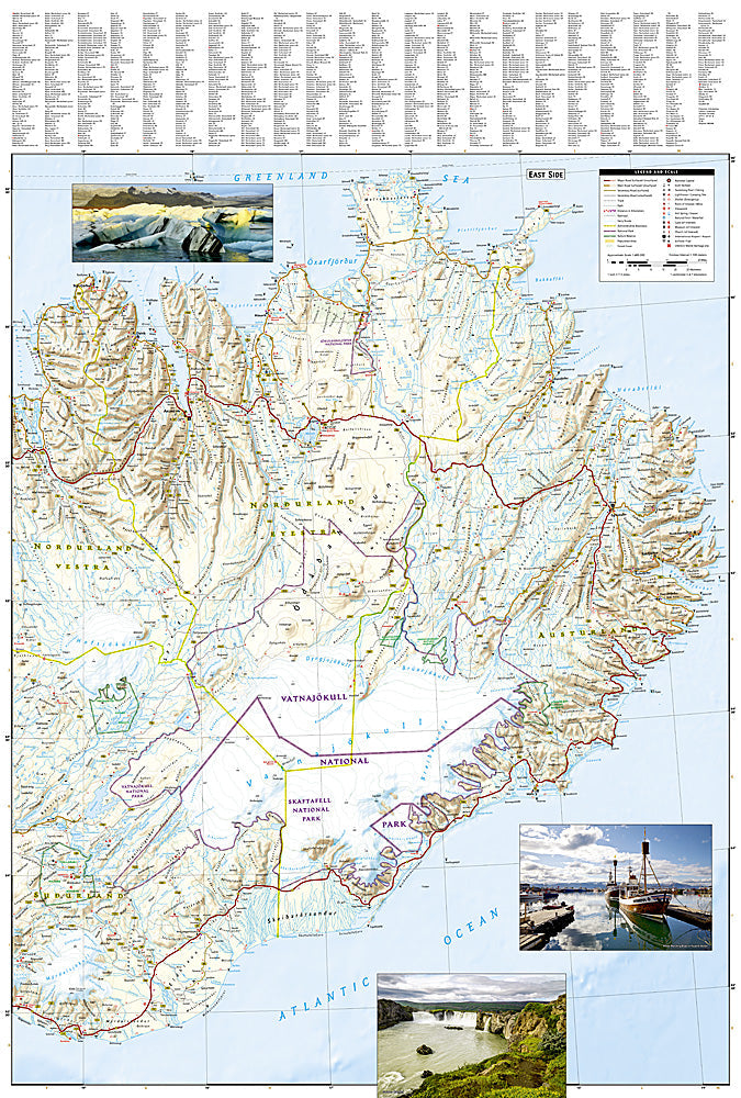
The National Geographic Adventure Map of Iceland (3302) covers the full island including the Ring Road, Laugavegur Trail, Vatnajökull glacier, Landmannalaugar, and the Westfjords with accurate topography, road networks, F-roads, and points of interest. Printed on waterproof, tear-resistant synthetic paper.
Key specs:
- SKU: NGAM3302
- Material: Waterproof, tear-resistant synthetic paper
- Folded size: 4.25" x 9.25"
- Open size: 26" x 38"
- Two-sided print with comprehensive place name index
Why it works:
Iceland's F-roads — highland interior tracks requiring 4WD — are not always accurately represented in digital navigation apps, and connectivity in the interior is unreliable. This map covers the full island including F-road designations, glacier routes, and highland trails with the detail needed for safe navigation in Iceland's remote interior and changing conditions.
Ideal for: Road trippers, trekkers, 4WD overlanders, and adventure travelers exploring Iceland's Ring Road, highland interior, glaciers, and Laugavegur Trail.
Share