National Geographic
Glacier & Waterton National Parks Wall Map - Standard (24" x 36")
Glacier & Waterton National Parks Wall Map - Standard (24" x 36")
Couldn't load pickup availability
National Geographic Glacier & Waterton National Parks Wall Map — Standard, 24" x 36". Trails Illustrated base cartography. Rolled (not tubed).
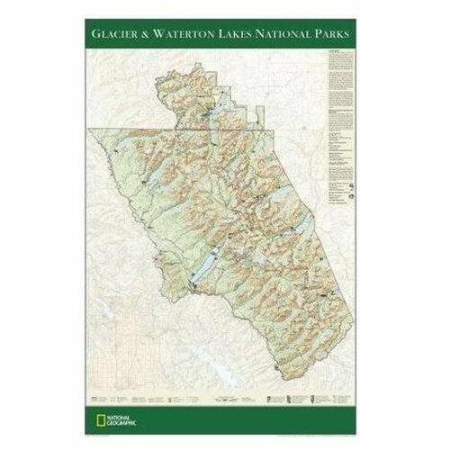
The Glacier & Waterton National Parks Wall Map covers both Glacier National Park (Montana) and Waterton Lakes National Park (Alberta) — together forming the Waterton-Glacier International Peace Park. Detailed mountain terrain, pristine lakes, Going-to-the-Sun Road, major hiking trails, campgrounds, and visitor facilities are all shown with National Geographic's trusted cartographic detail at a scale readable from the wall.
Key specs
- SKU: NGWM200
- Size: 24" x 36"
- Format: Standard (rolled)
- Material: High-quality paper print
- Series: Trails Illustrated Wall Map
- Coverage: Glacier NP (MT) & Waterton Lakes NP (AB)
Why it works
Glacier and Waterton together form one of the most spectacular mountain park complexes in North America. A large-format wall map captures the full scope of both parks — the Going-to-the-Sun Road corridor, 700+ miles of trails, and the dramatic Continental Divide terrain — in a format that works for both trip planning and wall display. The standard rolled format is the economical option for buyers who don't need tube protection.
Ideal for
Trip planning, home or office display, and as a gift for Glacier and Waterton visitors and mountain enthusiasts. See also the Tubed edition (NGWM201) for protected shipping.
Share