National Geographic
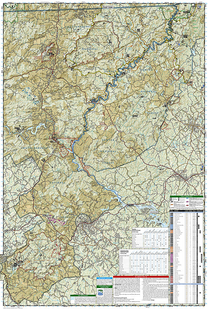
Brasstown Bald, Chattooga: Map #778
Brasstown Bald, Chattooga: Map #778
Couldn't load pickup availability
National Geographic Trails Illustrated Brasstown Bald & Chattooga Map #778 — waterproof, tear-resistant. Coverage of Brasstown Bald (Georgia's highest peak), the Chattooga Wild & Scenic River, and surrounding Chattahoochee National Forest. GPS-compatible.
The National Geographic Trails Illustrated Brasstown Bald & Chattooga Map covers the northeastern Georgia mountains — Brasstown Bald (4,784 ft, Georgia's highest point), the Chattooga Wild & Scenic River corridor, Tallulah Gorge, and surrounding Chattahoochee National Forest. Trails, waterfalls, river access, campgrounds, and GPS coordinates are mapped in detail.
Key specs
- SKU: NGTI778
- Map number: 778
- Coverage: Brasstown Bald & Chattooga area, Chattahoochee National Forest, Georgia
- Material: Waterproof, tear-resistant paper
- Features: Trails, Chattooga River access, waterfalls, Brasstown Bald summit, campgrounds, GPS coordinates
Why it works
The Chattooga River is one of the premier whitewater rivers in the eastern US — made famous by the film Deliverance — and its Wild & Scenic designation means accurate river access and rapid detail is essential for paddlers. Brasstown Bald's summit trail and the surrounding Appalachian Trail corridor add significant hiking coverage. Waterproof construction survives the frequent rain and high humidity common in the Georgia mountains year-round.
Ideal for
Hikers, rafters, and outdoor enthusiasts exploring Brasstown Bald, the Chattooga River, and the Chattahoochee National Forest in northeastern Georgia. See also NGTI785 (Nantahala & Cullasaja Gorges) for adjacent coverage in North Carolina.
Share