National Geographic
Adventure Map: Finland & Northern Scandinavia
Adventure Map: Finland & Northern Scandinavia
Couldn't load pickup availability
Waterproof, tear-resistant adventure map of Finland & Northern Scandinavia — topography, roads, trails, national parks, Arctic wilderness, and points of interest.
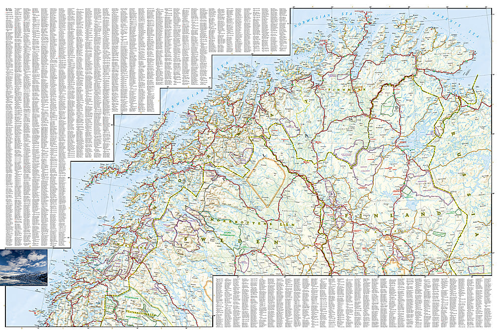
The National Geographic Adventure Map of Finland & Northern Scandinavia (3300) covers Finland, northern Norway, and northern Sweden with accurate topography, road networks, national parks, Arctic wilderness areas, and points of interest. Lapland, the North Cape, and the Northern Lights belt are all covered. Printed on waterproof, tear-resistant synthetic paper.
Key specs:
- SKU: NGAM3300
- Material: Waterproof, tear-resistant synthetic paper
- Folded size: 4.25" x 9.25"
- Open size: 26" x 38"
- Two-sided print with comprehensive place name index
Why it works:
Northern Scandinavia and Finland offer some of Europe's most remote and pristine wilderness — Finnish Lapland's reindeer herding lands, Norway's North Cape, and the Northern Lights belt above the Arctic Circle. Road distances are vast and services sparse, making accurate mapping of roads, national parks, and terrain essential for safe navigation in this remote region.
Ideal for: Road trippers, trekkers, Northern Lights chasers, and adventure travelers exploring Finland, Lapland, and Arctic Scandinavia.
Share