National Geographic
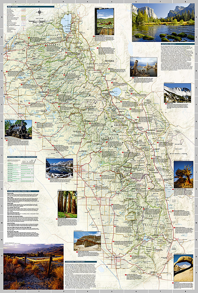
Sierra Nevada Destination Touring Map
Sierra Nevada Destination Touring Map
Couldn't load pickup availability
National Geographic Sierra Nevada Destination Touring Map — waterproof, tear-resistant, detailed topography of the range, major trails including JMT and PCT, national parks, and wilderness areas. Folded 4" x 8.75".
The National Geographic Sierra Nevada Destination Touring Map covers the full Sierra Nevada range from Lake Tahoe south to Mount Whitney, including Yosemite, Kings Canyon, and Sequoia National Parks. Major trails including the John Muir Trail and Pacific Crest Trail are mapped alongside wilderness areas, trailheads, and campgrounds.
Key specs
- SKU: NGDM001
- Coverage: Sierra Nevada range, California
- Folded size: 4" x 8.75"
- Material: Waterproof, tear-resistant synthetic paper
Why it works
The Sierra Nevada spans multiple national parks and wilderness areas across a 400-mile range — a single regional map that shows the full corridor with major trails, park boundaries, and access roads is essential for planning multi-park trips and long-distance trail sections. Waterproof construction survives the afternoon thunderstorms and stream crossings common throughout the Sierra.
Ideal for
Hikers, backpackers, climbers, and road trippers exploring the Sierra Nevada's national parks, wilderness areas, and long-distance trails. See also NGBM102 (Yosemite Benchmark Map) for detailed regional coverage around Yosemite.
Share