National Geographic
Caribbean Destination Touring Map & Guide
Caribbean Destination Touring Map & Guide
Couldn't load pickup availability
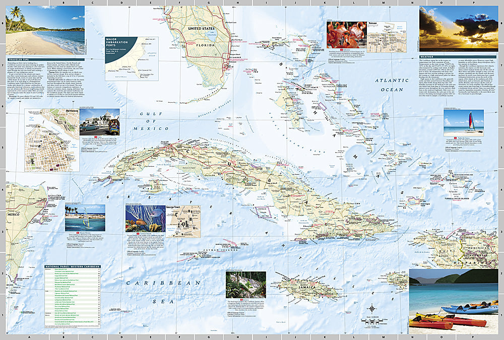
National Geographic Caribbean Destination Touring Map & Guide — waterproof, tear-resistant, detailed maps of major islands and archipelagos, cruise routes, ports of call, dive sites, and marine parks. Folded 4" x 8.75".
The National Geographic Caribbean Destination Touring Map covers the major islands and archipelagos of the Caribbean with cruise routes, ports of call, dive sites, marine parks, and points of interest. Designed for both pre-trip planning and on-the-ground navigation throughout the region.
Key specs
- SKU: NGDM004
- Coverage: Caribbean islands and archipelagos
- Folded size: 4" x 8.75"
- Material: Waterproof, tear-resistant synthetic paper
Why it works
The Caribbean's scattered island geography makes regional orientation essential for cruise passengers and island-hoppers who need to understand the spatial relationships between islands, ports, and routes. A single waterproof map covering the full region is far more practical than managing multiple island-specific maps on a boat or beach. Waterproof construction is essential in a marine environment where salt spray and rain are constant.
Ideal for
Cruise passengers, sailors, divers, and island-hoppers exploring the Caribbean. See also NGAM3107 (Puerto Rico) and NGAM3116 (Jamaica) for individual island coverage.
Share