National Geographic
Alaska's Inside Passage Destination Touring Map
Alaska's Inside Passage Destination Touring Map
Couldn't load pickup availability
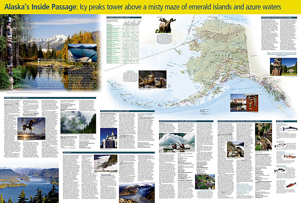
National Geographic Alaska's Inside Passage Destination Touring Map — waterproof, tear-resistant, detailed coastal topography, ferry routes, ports, anchorages, wildlife viewing areas, and national parks. Folded 4" x 8.75".
The National Geographic Alaska's Inside Passage Destination Touring Map covers the coastal wilderness from Puget Sound north through British Columbia to Southeast Alaska. Ferry routes, ports, anchorages, wildlife viewing areas, Tongass National Forest, and national parks are mapped in detail. Designed for cruise passengers, boaters, kayakers, and ferry travelers navigating the Inside Passage.
Key specs
- SKU: NGDM003
- Coverage: Alaska's Inside Passage (Southeast Alaska and BC coast)
- Folded size: 4" x 8.75"
- Material: Waterproof, tear-resistant synthetic paper
Why it works
The Inside Passage's complex coastal geography — thousands of islands, fjords, and channels — makes spatial orientation essential for understanding where you are relative to ports, wildlife areas, and national parks. Cruise passengers and ferry travelers benefit from being able to follow their route on a map rather than relying solely on onboard announcements. Waterproof construction is essential in Southeast Alaska's extremely wet climate and marine environment.
Ideal for
Cruise passengers, boaters, kayakers, and ferry travelers exploring Alaska's Inside Passage, Tongass National Forest, and Southeast Alaska's coastal wilderness. See also NGAM3117 (Alaska Adventure Map) for broader Alaska coverage.
Share