National Geographic
New York City Destination Map
New York City Destination Map
Couldn't load pickup availability
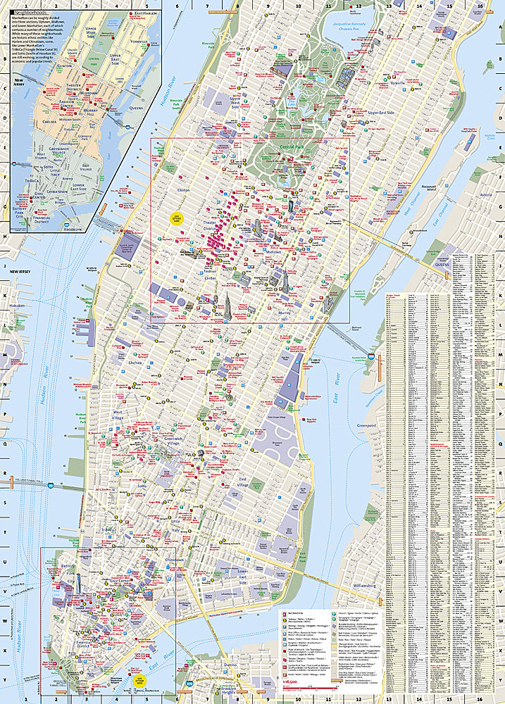
National Geographic City Destination Map of New York City — waterproof, tear-resistant, comprehensive street maps of Manhattan and boroughs, subway lines and stations, Central Park detail, and major landmarks. Folded 4" x 8.75".
The National Geographic New York City Destination Map covers Manhattan and the boroughs with a comprehensive street network, all subway lines and stations clearly marked, Central Park detail, and major landmarks including the Brooklyn Bridge, Empire State Building, and Times Square. Points of interest, cultural sites, and visitor information throughout.
Key specs
- SKU: NGDC006
- Coverage: New York City (Manhattan and boroughs)
- Folded size: 4" x 8.75"
- Material: Waterproof, tear-resistant synthetic paper
Why it works
New York City's grid system is logical but the subway network — with its local and express tracks, multiple lines sharing stations, and borough connections — is notoriously confusing for first-time visitors. Having both the street map and subway map on a single waterproof sheet eliminates the need to switch between a phone map and a transit app while navigating underground. Waterproof construction survives New York's rain and the humidity of the subway system.
Ideal for
Tourists, urban adventurers, and first-time visitors navigating New York City's streets, subway, and neighborhoods. See also NGGM042 (New York State Road Map) for broader statewide coverage.
Share