National Geographic
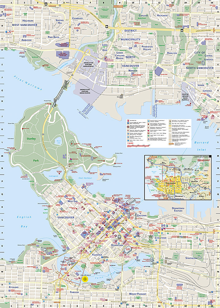
Vancouver City Destination Map
Vancouver City Destination Map
Couldn't load pickup availability
National Geographic City Destination Map of Vancouver — waterproof, tear-resistant, detailed street maps, transit info, downtown and metro area coverage, parks and bike paths. Folded 4" x 8.75".
The National Geographic Vancouver City Destination Map covers downtown Vancouver and the metro area with detailed street maps, transit routes, Stanley Park, Granville Island, and the city's diverse neighborhoods. Parks, bike paths, and points of interest are highlighted throughout.
Key specs
- SKU: NGDC009
- Coverage: Vancouver city and metro area
- Folded size: 4" x 8.75"
- Material: Waterproof, tear-resistant synthetic paper
Why it works
Vancouver's combination of a compact downtown, Stanley Park peninsula, and surrounding mountains and water makes orientation challenging for first-time visitors. The street map and transit overlay together make it easy to navigate between neighborhoods, the waterfront, and major attractions without relying on a phone in an unfamiliar city. Waterproof construction handles Vancouver's frequent rain.
Ideal for
Tourists, urban adventurers, and nature-loving visitors exploring Vancouver's neighborhoods, parks, and waterfront. See also NGAM3128 (Vancouver Island Adventure Map) for broader regional coverage.
Share