National Geographic
Sydney City Destination Map
Sydney City Destination Map
Couldn't load pickup availability
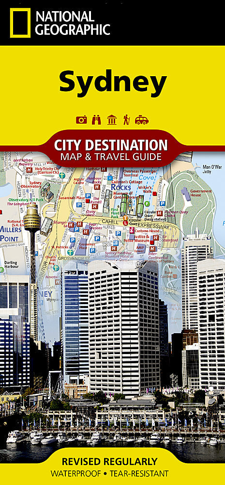
National Geographic City Destination Map of Sydney — waterproof, tear-resistant, detailed street maps of Sydney and suburbs, public transport routes including ferries and trains, points of interest, and visitor centers. Folded 4" x 8.75".
The National Geographic Sydney City Destination Map covers Sydney's street network and suburbs with public transport routes including ferry lines, trains, and buses. The Opera House, Harbour Bridge, Bondi Beach, and major neighborhoods are detailed. Points of interest and visitor information throughout.
Key specs
- SKU: NGDC023
- Coverage: Sydney city and suburbs
- Folded size: 4" x 8.75"
- Material: Waterproof, tear-resistant synthetic paper
Why it works
Sydney's sprawling harbor geography — with the CBD, North Shore, Eastern Suburbs, and Inner West separated by water and connected by ferries, trains, and bridges — makes spatial orientation essential for navigating efficiently. The ferry route overlay is particularly useful for visitors who want to use Sydney's iconic harbor ferries to reach Manly, Taronga Zoo, and other waterfront destinations. Waterproof construction handles Sydney's summer storms and coastal humidity.
Ideal for
Tourists, city explorers, and beach-hoppers visiting Sydney's harbor, neighborhoods, and beaches. See also NGAM3502 (Australia East Adventure Map) for broader eastern Australia coverage.
Share