National Geographic
Las Vegas City Destination Map
Las Vegas City Destination Map
Couldn't load pickup availability
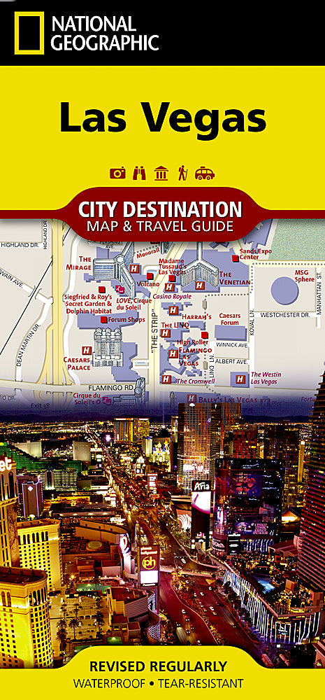
National Geographic City Destination Map of Las Vegas — waterproof, tear-resistant, detailed street maps of the Strip and downtown, hotel and casino locations, theater and venue listings, and regional map for day trips. Folded 4" x 8.75".
The National Geographic Las Vegas City Destination Map covers the Strip and downtown Las Vegas with detailed street maps, hotel, casino, and theater locations, and a regional map for planning day trips to Red Rock Canyon, Hoover Dam, and the surrounding desert. Points of interest and visitor information throughout.
Key specs
- SKU: NGDC017
- Coverage: Las Vegas Strip, downtown, and surrounding region
- Folded size: 4" x 8.75"
- Material: Waterproof, tear-resistant synthetic paper
Why it works
The Las Vegas Strip's dense concentration of hotels, casinos, and venues — many with complex internal layouts and multiple entrances — makes a detailed street-level map essential for navigating efficiently on foot. The regional map for day trips to Red Rock Canyon, Valley of Fire, and Hoover Dam adds value beyond the city itself. Waterproof construction handles the desert heat and the occasional rain that can catch visitors off guard.
Ideal for
Vegas vacationers, convention attendees, and day trippers exploring Las Vegas and the surrounding Mojave Desert.
Share