National Geographic
Central Cascades Destination Touring Map & Guide
Central Cascades Destination Touring Map & Guide
Couldn't load pickup availability
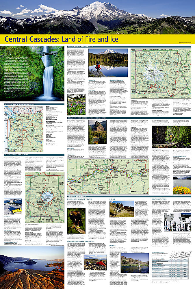
National Geographic Central Cascades Destination Touring Map & Guide — waterproof, tear-resistant, detailed topography of the Cascade Range in Oregon and Washington, PCT sections, trailheads, campsites, and wilderness area boundaries. Folded 4" x 8.75".
The National Geographic Central Cascades Destination Touring Map covers the volcanic peaks and wilderness areas of the central Cascade Range across Oregon and Washington. Pacific Crest Trail sections, trailheads, campsites, water sources, and wilderness area boundaries are mapped in detail.
Key specs
- SKU: NGDM005
- Coverage: Central Cascade Range, Oregon and Washington
- Folded size: 4" x 8.75"
- Material: Waterproof, tear-resistant synthetic paper
Why it works
The Central Cascades' volcanic peaks, wilderness areas, and PCT corridor span the Oregon-Washington border in a region where trail access, wilderness boundaries, and permit requirements vary significantly by area. A regional map covering the full corridor with trailhead and campsite detail is essential for planning multi-day trips and PCT sections. Waterproof construction is critical in the Cascades, where rain is frequent on the west side and afternoon thunderstorms are common on the east.
Ideal for
Backpackers, mountaineers, and PCT hikers exploring the Central Cascades' wilderness areas and volcanic peaks. See also NGGM050 (Oregon Road Map) and NGGM076 (Washington Road Map) for broader state coverage.
Share