National Geographic
Skyline Boulevard: Map #815
Skyline Boulevard: Map #815
Couldn't load pickup availability
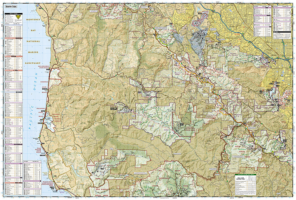
National Geographic Trails Illustrated Skyline Boulevard Map #815 — waterproof, tear-resistant. Coverage of the Skyline-to-the-Sea corridor along the Santa Cruz Mountains Peninsula including Purisima Creek Redwoods, Windy Hill, and surrounding Peninsula open space preserves in California. GPS-compatible.
The National Geographic Trails Illustrated Skyline Boulevard Map covers the Skyline ridge corridor along the San Francisco Peninsula — Purisima Creek Redwoods, Windy Hill Open Space Preserve, El Corte de Madera Creek, and surrounding Midpeninsula Regional Open Space District preserves. Hiking and mountain biking trails, trailheads, and GPS coordinates are mapped in detail.
Key specs
- SKU: NGTI815
- Map number: 815
- Coverage: Skyline Boulevard corridor, San Francisco Peninsula, California
- Material: Waterproof, tear-resistant paper
- Features: Trails, Peninsula open space preserves, mountain biking routes, trailheads, GPS coordinates
Why it works
The Skyline ridge's network of open space preserves offers extensive hiking and mountain biking accessible from San Francisco, Silicon Valley, and the Peninsula — the interconnected preserve system requires a map covering the full corridor to plan point-to-point routes efficiently. The Purisima Creek Redwoods' canyon trails and the ridge-top views from Windy Hill require accurate trail detail for navigation. Waterproof construction survives the coastal fog and rain common along the Peninsula year-round.
Ideal for
Hikers, mountain bikers, and outdoor enthusiasts exploring the Skyline Boulevard corridor's open space preserves on the San Francisco Peninsula. See also NGTI816 (Big Basin & Santa Cruz) for adjacent coverage to the south.
Share