Benchmark Maps
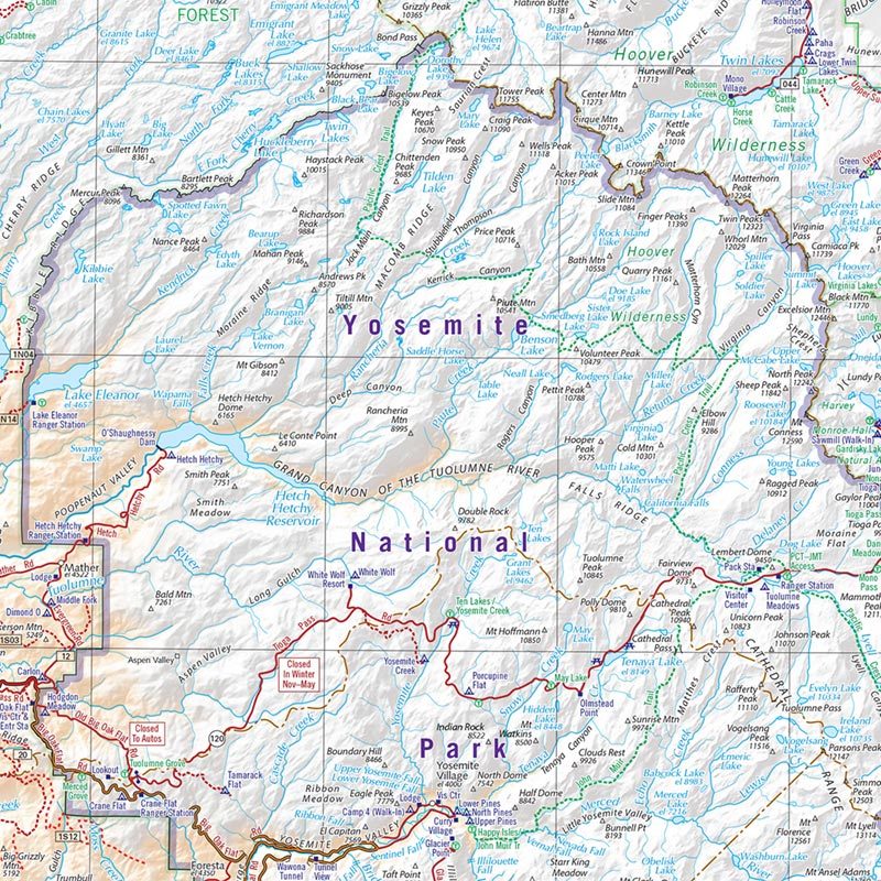
Benchmark Map: Yosemite National Park Area
Benchmark Map: Yosemite National Park Area
Couldn't load pickup availability
National Geographic Benchmark Map of the Yosemite National Park area — waterproof, tear-resistant, regional recreation coverage including roads, trails, campgrounds, park and forest boundaries. For road trips, hiking, and camping in the Yosemite region.
The National Geographic Benchmark Map: Yosemite National Park Area provides comprehensive regional coverage of Yosemite and surrounding national forests and public lands. Roads, trails, campgrounds, park and forest boundaries, and recreation sites on waterproof, tear-resistant paper built for field use.
Key specs
- SKU: NGBM102
- Publisher: National Geographic / Benchmark Maps
- Coverage: Yosemite National Park and surrounding region
- Material: Waterproof, tear-resistant paper
- Features: Roads, trails, campgrounds, park & forest boundaries, recreation sites
Why it works
Yosemite's surrounding region — including Stanislaus, Sierra, and Inyo National Forests — offers extensive recreation beyond the park boundary that standard park maps don't cover. A regional Benchmark map provides the broader context needed for planning multi-day trips that combine Yosemite with adjacent wilderness areas and national forests. Waterproof construction survives the rain and stream crossings common in the Sierra Nevada.
Ideal for
Road trippers, hikers, campers, and backpackers exploring Yosemite National Park and the surrounding Sierra Nevada region. See also NGTI206 (Yosemite Valley) for detailed in-park trail coverage.
Share