Benchmark Maps
Benchmark Map: Washington
Benchmark Map: Washington
Couldn't load pickup availability
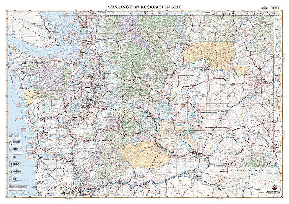
National Geographic Benchmark Map of Washington State — waterproof, tear-resistant, statewide recreation coverage including roads, trails, campgrounds, parks, forests, and wildlife areas. For road trips, hiking, camping, and outdoor exploration across Washington.
The National Geographic Benchmark Map: Washington provides comprehensive statewide coverage of Washington's roads, national forests, state parks, wilderness areas, wildlife areas, campgrounds, and scenic routes. Waterproof, tear-resistant paper built for field use across Washington's diverse terrain from the Cascades to the Olympic Peninsula and Columbia Basin.
Key specs
- SKU: NGBM050
- Publisher: National Geographic / Benchmark Maps
- Coverage: Full state of Washington
- Material: Waterproof, tear-resistant paper
- Features: Roads, trails, campgrounds, national forests, state parks, wildlife areas, scenic routes
Why it works
Washington's public lands span the Cascades, Olympics, and Columbia Basin — a complex mix of national forests, wilderness areas, state parks, and wildlife areas that standard road maps don't cover in sufficient recreation detail. Benchmark's cartography provides the public land boundaries, campground locations, and backroad detail needed for planning hunting, fishing, hiking, and camping trips across the state. Waterproof construction survives Washington's frequent rain.
Ideal for
Hunters, anglers, hikers, campers, and road trippers exploring Washington's national forests, state parks, wilderness areas, and backroads. See also NGBA011 (Washington Road Recreation Atlas) for more detailed county-level coverage.
Share