National Geographic
Arkansas River Map Bundle
Arkansas River Map Bundle
Couldn't load pickup availability
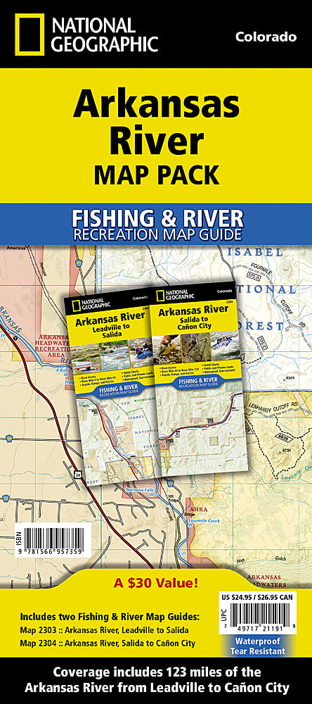
Two-map bundle covering the full Arkansas River from Leadville to Cañon City — waterproof, tear-resistant. Includes maps 2303 and 2304.
The National Geographic Arkansas River Fishing Map Bundle includes both Arkansas River map sections — Leadville to Salida (NGFR2303) and Salida to Cañon City (NGFR2304) — giving you complete coverage of the Arkansas River from the headwaters through the Royal Gorge. Rapid classifications, Gold Medal fishing water, access easements, campgrounds, and public land boundaries on waterproof, tear-resistant paper.
Bundle includes:
- NGFR2303: Arkansas River, Leadville to Salida (upper headwaters, Buena Vista whitewater)
- NGFR2304: Arkansas River, Salida to Cañon City (Royal Gorge, Bighorn Sheep Canyon)
Key specs (each map):
- SKU: NGFR001
- Scale: 1" = ½ mile
- Folded size: 4.25" x 9.38"
- Material: Waterproof, tear-resistant paper with stainless steel staples
- Full UTM grid for GPS navigation
- Weight: ~3.2 oz per map
Why it works:
The Arkansas River is Colorado's most popular whitewater river and one of its premier Gold Medal fisheries. Having both map sections in one purchase means you can plan and navigate the full river from the headwaters to the Royal Gorge without gaps in coverage — essential for multi-day float trips and extended fishing excursions.
Ideal for: Rafters, kayakers, and fly fishers planning trips on the full Arkansas River corridor from Leadville to Cañon City.
Share