National Geographic
Adventure Map: Turkey Mediterranean Coast
Adventure Map: Turkey Mediterranean Coast
Couldn't load pickup availability
Waterproof, tear-resistant adventure map of Turkey's Mediterranean Coast — topography, roads, trails, Lycian Way, ancient ruins, and points of interest.
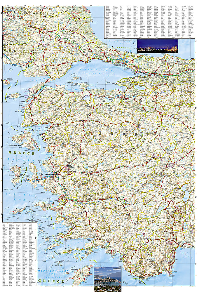
The National Geographic Adventure Map of Turkey Mediterranean Coast (3019) covers the Turquoise Coast from Bodrum and Marmaris east through Fethiye, Kas, Antalya, and Side with accurate topography, road networks, the Lycian Way trail, ancient Lycian ruins, and points of interest. Printed on waterproof, tear-resistant synthetic paper.
Key specs:
- SKU: NGAM3019
- Material: Waterproof, tear-resistant synthetic paper
- Folded size: 4.25" x 9.25"
- Open size: 26" x 38"
- Two-sided print with comprehensive place name index
Why it works:
Turkey's Mediterranean coast combines the Lycian Way — one of the world's great long-distance walking routes — with some of the best-preserved ancient Greek and Roman ruins outside Italy, and exceptional sailing and diving. This map covers the full Turquoise Coast with the road and trail detail needed for hiking the Lycian Way, road trips, and exploring the region's archaeological sites.
Ideal for: Hikers on the Lycian Way, road trippers, sailors, and adventure travelers exploring Turkey's Turquoise Coast and ancient Lycian ruins.
Share