National Geographic
Adventure Map: Tanzania, Rwanda & Burundi
Adventure Map: Tanzania, Rwanda & Burundi
Couldn't load pickup availability
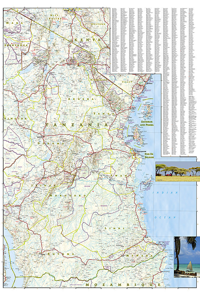
National Geographic Adventure Map of Tanzania, Rwanda & Burundi — waterproof, tear-resistant, detailed topography, roads, national parks, and safari destinations. For safari, trekking, and overland travel in East Africa.
The National Geographic Adventure Map 3206 covers Tanzania, Rwanda, and Burundi with detailed topography including the Serengeti, Kilimanjaro, Ngorongoro Crater, Virunga volcanoes, and the Great Rift Valley lakes. Roads, national parks, game reserves, and cultural landmarks on waterproof, tear-resistant paper built for field use.
Key specs:
- SKU: NGAM3206
- Map number: 3206
- Coverage: Tanzania, Rwanda & Burundi
- Material: Waterproof, tear-resistant paper
- Features: Detailed topography, roads, national parks, game reserves, cultural landmarks
Why it works:
East Africa's national parks and game reserves span vast distances with limited road infrastructure — accurate park boundaries, road networks, and terrain detail are essential for planning safari routes and overland travel. Waterproof construction survives the rain and humidity of the East African climate.
Ideal for: Safari travelers, overlanders, and trekkers exploring Tanzania's Serengeti and Kilimanjaro, Rwanda's gorilla trekking, and the Great Rift Valley. See also NGAM3205 (Kenya) and NGAM3204 (South Africa) for adjacent African coverage.
Share