National Geographic
Adventure Map: Myanmar (Burma)
Adventure Map: Myanmar (Burma)
Couldn't load pickup availability
Waterproof, tear-resistant adventure map of Myanmar — topography, roads, trails, national parks, Bagan, Inle Lake, and points of interest.
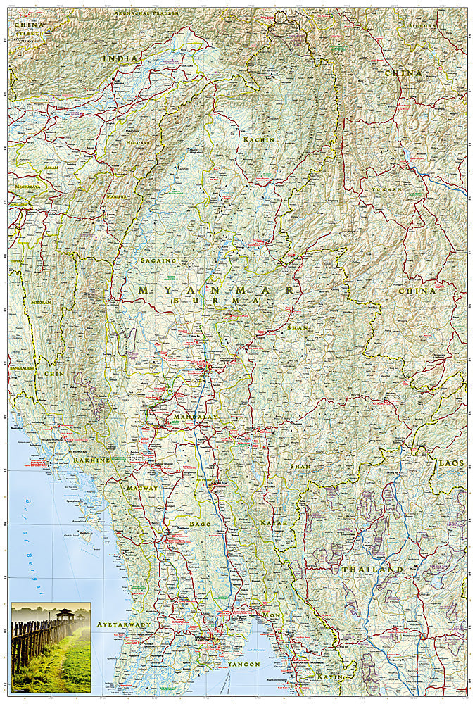
The National Geographic Adventure Map of Myanmar (3025) covers the country including Bagan's temple plains, Inle Lake, Mandalay, the Irrawaddy River corridor, and Shan State with accurate topography, road networks, and points of interest. Printed on waterproof, tear-resistant synthetic paper.
Key specs:
- SKU: NGAM3025
- Material: Waterproof, tear-resistant synthetic paper
- Folded size: 4.25" x 9.25"
- Open size: 26" x 38"
- Two-sided print with comprehensive place name index
Why it works:
Myanmar's road network and signage can be challenging to navigate, and digital connectivity is unreliable outside major cities. A detailed printed map covering roads, towns, national parks, and points of interest is an essential tool for independent travel across Myanmar's diverse regions — from Bagan's archaeological zone to the Shan Plateau and Inle Lake.
Ideal for: Independent travelers, backpackers, and adventure travelers exploring Myanmar's temples, national parks, and diverse landscapes.
Share