National Geographic
Adventure Map: Langtang
Adventure Map: Langtang
Couldn't load pickup availability
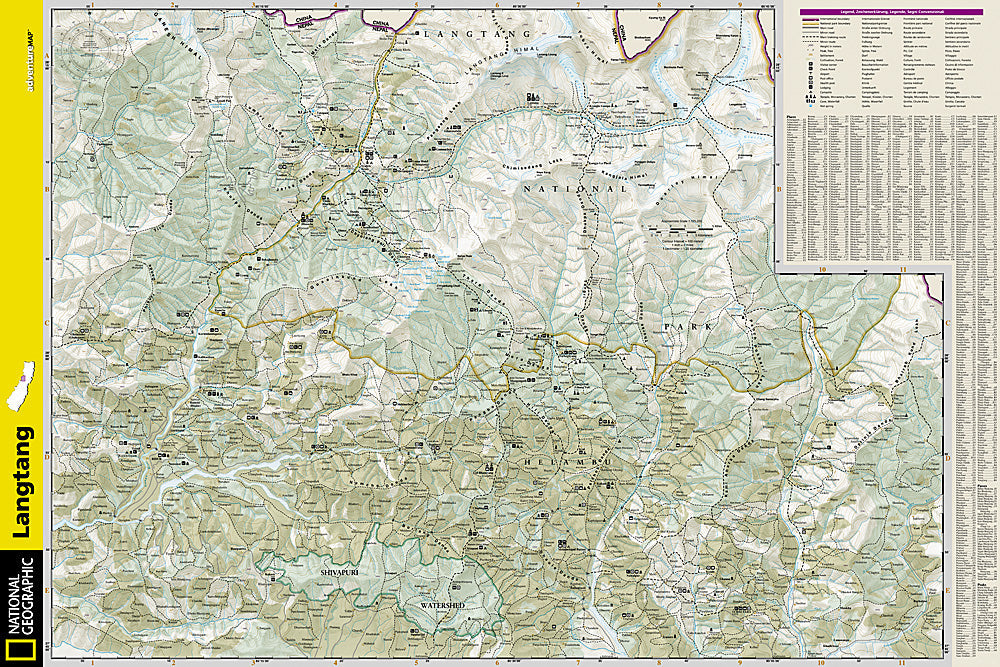
Waterproof, tear-resistant topographic map of the Langtang region — trails, villages, teahouses, Gosaikunda Lake, and high-altitude terrain.
The National Geographic Adventure Map of Langtang (3004) covers Nepal's Langtang Valley, Gosaikunda Lake, Helambu circuit, and surrounding high-altitude terrain with detailed topography, trail networks, villages, and teahouses. Printed on waterproof, tear-resistant synthetic paper essential for Himalayan conditions.
Key specs:
- SKU: NGAM3004
- Material: Waterproof, tear-resistant synthetic paper
- Folded size: 4.25" x 9.25"
- Open size: 26" x 38"
- Two-sided print with comprehensive place name index
Why it works:
The Langtang Valley is one of Nepal's most accessible trekking regions — just a few hours from Kathmandu — offering high-altitude Himalayan scenery without the crowds of the Everest and Annapurna circuits. The Gosaikunda Lake pilgrimage route and Helambu circuit extend the trekking options. Accurate topographic mapping is essential for safe navigation in this high-altitude environment.
Ideal for: Trekkers completing the Langtang Valley trek, Gosaikunda Lake route, and Helambu circuit in Nepal's Langtang National Park.
Share