National Geographic
Adventure Map: Khumbu
Adventure Map: Khumbu
Couldn't load pickup availability
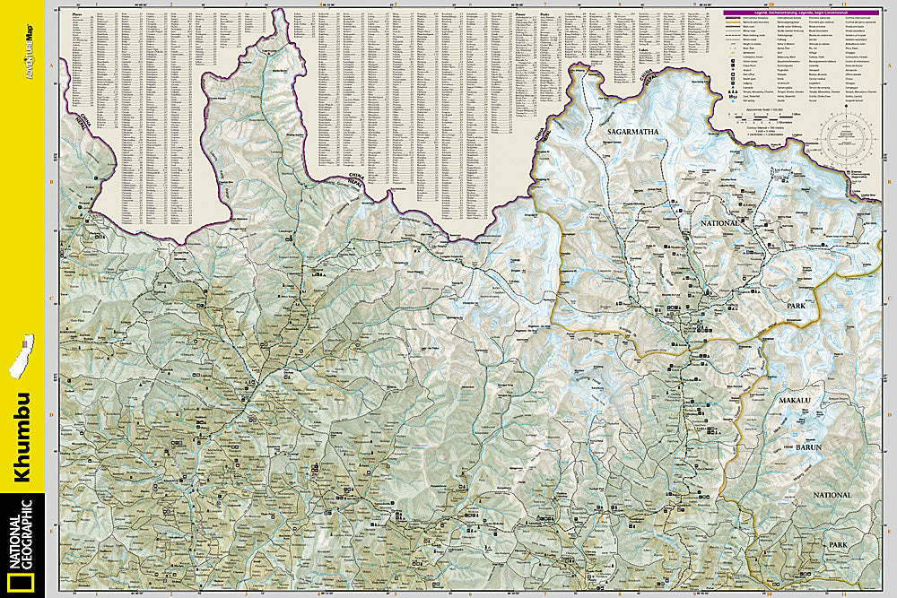
Waterproof, tear-resistant topographic map of the Khumbu region — trails, villages, teahouses, Three Passes, Gokyo Lakes, and high-altitude terrain.
The National Geographic Adventure Map of Khumbu (3002) covers Nepal's Khumbu region in detail including the Everest Base Camp trail, Three Passes Trek, Gokyo Lakes, Namche Bazaar, and surrounding high-altitude terrain with detailed topography, trail networks, villages, and teahouses. Printed on waterproof, tear-resistant synthetic paper essential for Himalayan conditions.
Key specs:
- SKU: NGAM3002
- Material: Waterproof, tear-resistant synthetic paper
- Folded size: 4.25" x 9.25"
- Open size: 26" x 38"
- Two-sided print with comprehensive place name index
Why it works:
The Khumbu region offers multiple trekking routes beyond the standard Everest Base Camp trail — the Three Passes Trek, Gokyo Lakes, and Island Peak approach all require detailed topographic mapping for safe navigation at altitude. This map covers the full Khumbu region with the trail and terrain detail needed for planning and navigating all major routes in the area.
Ideal for: Trekkers completing the Three Passes Trek, Gokyo Lakes route, Everest Base Camp, and other trails in Nepal's Khumbu region.
Share