National Geographic
Adventure Map: Cyprus
Adventure Map: Cyprus
Couldn't load pickup availability
Waterproof, tear-resistant adventure map of Cyprus — topography, roads, trails, Troodos Mountains, national parks, and points of interest.
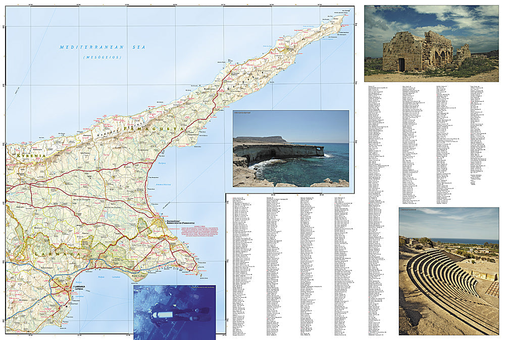
The National Geographic Adventure Map of Cyprus (3318) covers the island including the Troodos Mountains, Akamas Peninsula, Kyrenia range, and Mediterranean coastline with accurate topography, road networks, hiking trails, and points of interest. Printed on waterproof, tear-resistant synthetic paper.
Key specs:
- SKU: NGAM3318
- Material: Waterproof, tear-resistant synthetic paper
- Folded size: 4.25" x 9.25"
- Open size: 26" x 38"
- Two-sided print with comprehensive place name index
Why it works:
Cyprus extends well beyond its beach resorts — the Troodos Mountains have Byzantine monasteries, wine villages, and hiking trails, the Akamas Peninsula is a protected wilderness area, and the island has significant ancient Greek and Roman archaeological sites. This map covers the full island with the road and trail detail needed for exploring beyond the coastal tourist areas.
Ideal for: Hikers, road trippers, history enthusiasts, and adventure travelers exploring Cyprus's Troodos Mountains, Akamas Peninsula, and archaeological sites.
Share