National Geographic
Adventure Map: Austria
Adventure Map: Austria
Couldn't load pickup availability
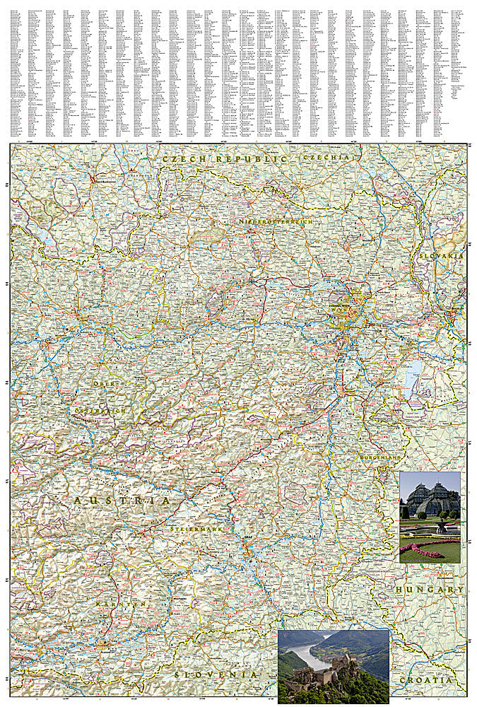
National Geographic Adventure Map of Austria — waterproof, tear-resistant, detailed topography, roads, trails, national parks, and cultural landmarks. For travel, hiking, cycling, and road trips.
The National Geographic Adventure Map 3319 covers Austria with detailed topography including the Alps, Danube Valley, and major mountain ranges. Roads, trails, rail connections, national parks, hiking routes, and cultural landmarks on waterproof, tear-resistant paper built for field use.
Key specs:
- SKU: NGAM3319
- Map number: 3319
- Coverage: Austria
- Material: Waterproof, tear-resistant paper
- Features: Detailed topography, roads, trails, national parks, cultural landmarks
Why it works:
Austria's terrain ranges from the high Alps in the west to the Pannonian lowlands in the east — a single map that covers the full country with accurate topography and road networks is essential for planning multi-region trips. Waterproof construction survives rain, river crossings, and pack compression that would destroy a standard paper map.
Ideal for: Travelers, hikers, cyclists, and road trippers exploring Austria's alpine regions, Danube bike trails, and historic cities. See also NGAM3320 (Switzerland) and NGAM3321 (The Alps) for adjacent coverage.
Share