National Geographic
Absaroka-Beartooth Wilderness: Map Pack Bundle
Absaroka-Beartooth Wilderness: Map Pack Bundle
Couldn't load pickup availability
National Geographic Trails Illustrated Absaroka-Beartooth Wilderness Map Pack Bundle — waterproof, tear-resistant, detailed topography, hiking trails, alpine lakes, and peak bagging routes. For backpackers, mountaineers, and wilderness lovers in Montana.
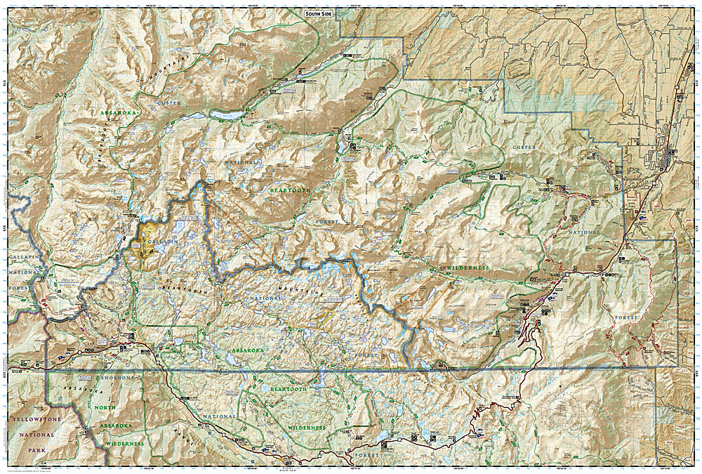
The National Geographic Absaroka-Beartooth Wilderness Map Pack Bundle includes the Trails Illustrated maps covering the Absaroka-Beartooth Wilderness — Montana's highest peaks and plateaus north of Yellowstone, including the Beartooth Plateau, Stillwater drainage, and surrounding wilderness areas. Detailed topography, trail networks, alpine lakes, and backcountry routes on waterproof, tear-resistant paper.
Key specs
- SKU: NGTIB304
- Coverage: Absaroka-Beartooth Wilderness, Montana
- Material: Waterproof, tear-resistant paper
- Features: Detailed topography, hiking trails, alpine lakes, peak bagging routes, backcountry campsites
- Format: Multi-map bundle
Why it works
The Absaroka-Beartooth Wilderness is one of the largest wilderness areas in the lower 48 states, spanning nearly 1 million acres of Montana's highest terrain — a bundle covering the full wilderness ensures complete coverage for extended backcountry trips without gaps between maps. The Beartooth Plateau's complex alpine terrain and dense network of alpine lakes require detailed topographic mapping for safe navigation. Waterproof construction is essential in Montana's high country where afternoon thunderstorms and early-season snow are constant hazards.
Ideal for
Backpackers, mountaineers, and wilderness lovers exploring the Absaroka-Beartooth Wilderness north of Yellowstone. See also NGTIB052 (Yellowstone & Grand Teton Bundle) for adjacent park coverage.
Share