National Geographic
Nantahala & Cullasaja Gorges: Map #785
Nantahala & Cullasaja Gorges: Map #785
Couldn't load pickup availability
National Geographic Trails Illustrated Nantahala & Cullasaja Gorges Map #785 — waterproof, tear-resistant. Coverage of the Nantahala National Forest, Nantahala Gorge, Cullasaja Gorge, and surrounding western North Carolina wilderness. GPS-compatible.
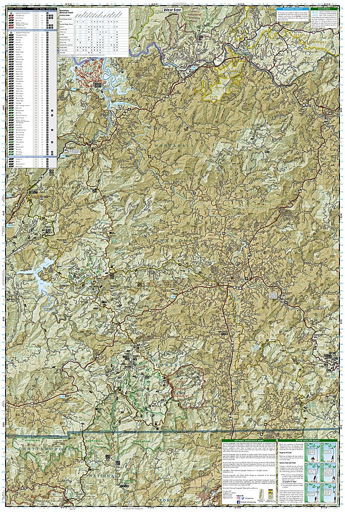
The National Geographic Trails Illustrated Nantahala & Cullasaja Gorges Map covers the Nantahala National Forest in western North Carolina including the Nantahala Gorge, Cullasaja Gorge, Wayah Bald, Standing Indian Wilderness, and the Appalachian Trail corridor. Trails, whitewater access, waterfalls, trailheads, and GPS coordinates are mapped in detail.
Key specs
- SKU: NGTI785
- Map number: 785
- Coverage: Nantahala & Cullasaja Gorges, Nantahala National Forest, North Carolina
- Material: Waterproof, tear-resistant paper
- Features: Trails, AT corridor, Nantahala River access, waterfalls, trailheads, GPS coordinates
Why it works
The Nantahala Gorge is one of the most popular whitewater destinations in the eastern US, and the surrounding national forest offers extensive hiking including the Appalachian Trail over Wayah Bald — a map covering both the river corridor and the surrounding trail network is essential for visitors who want to combine paddling and hiking. The Cullasaja Gorge's dramatic waterfalls are a major draw that require accurate road and trail detail to access safely. Waterproof construction survives the frequent rain and river use common in western North Carolina.
Ideal for
Hikers, paddlers, and outdoor enthusiasts exploring the Nantahala Gorge, Cullasaja Gorge, and Nantahala National Forest in western North Carolina. See also NGTI784 (Fontana, Hiwassee) for adjacent coverage.
Share