National Geographic
Mount Rainier National Park: Map #217
Mount Rainier National Park: Map #217
Couldn't load pickup availability
National Geographic Trails Illustrated Mount Rainier National Park Map #217 — waterproof, tear-resistant. Coverage of Mount Rainier National Park including the Wonderland Trail, climbing routes, Paradise, Sunrise, and surrounding backcountry. GPS-compatible.
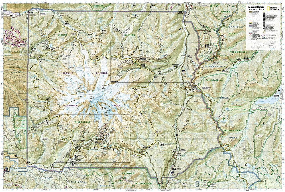
The National Geographic Trails Illustrated Mount Rainier National Park Map covers the full park including the 93-mile Wonderland Trail circumnavigating the mountain, all major climbing routes, Paradise, Sunrise, Carbon River, and the surrounding backcountry. Trails, backcountry campsites, glacier coverage, visitor facilities, and GPS coordinates are mapped in detail.
Key specs
- SKU: NGTI217
- Map number: 217
- Coverage: Mount Rainier National Park, Washington
- Material: Waterproof, tear-resistant paper
- Features: Wonderland Trail, climbing routes, glaciers, backcountry campsites, visitor facilities, GPS coordinates
Why it works
Mount Rainier is the most glaciated peak in the contiguous US and one of the most popular mountaineering objectives in North America — accurate glacier approach and route detail is essential for climbers planning ascents via the Disappointment Cleaver, Emmons Glacier, and other routes. The Wonderland Trail's 93-mile loop requires detailed campsite and water source mapping for planning the permitted backcountry trip. Waterproof construction survives Rainier's notoriously wet weather and the glacier travel that exposes maps to constant moisture.
Ideal for
Mountaineers, Wonderland Trail hikers, backpackers, and park visitors exploring Mount Rainier National Park. See also NGTI1014 (Wonderland Trail Map) for dedicated Wonderland Trail coverage and NGTIB202 (Washington National Parks Bundle) for all three Washington parks.
Share