National Geographic
Mount Mansfield, Stowe: Map #749
Mount Mansfield, Stowe: Map #749
Couldn't load pickup availability
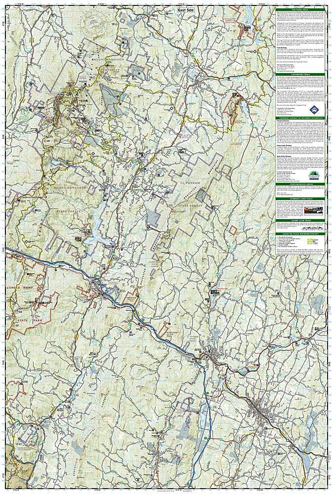
National Geographic Trails Illustrated Mount Mansfield & Stowe Map #749 — waterproof, tear-resistant. Coverage of Mount Mansfield (Vermont's highest peak), the Long Trail, Stowe, and surrounding Green Mountain National Forest. GPS-compatible.
The National Geographic Trails Illustrated Mount Mansfield & Stowe Map covers Vermont's highest peak and the surrounding Stowe area — Mount Mansfield (4,393 ft), the Long Trail ridge traverse, Stowe ski area, Smugglers' Notch, and surrounding Green Mountain National Forest. Trails, Long Trail route, ski terrain, trailheads, and GPS coordinates are mapped in detail.
Key specs
- SKU: NGTI749
- Map number: 749
- Coverage: Mount Mansfield & Stowe area, Vermont
- Material: Waterproof, tear-resistant paper
- Features: Trails, Long Trail, Mount Mansfield summit routes, Smugglers' Notch, ski terrain, GPS coordinates
Why it works
Mount Mansfield's summit ridge is one of the most popular hiking destinations in Vermont, with multiple approach routes and the Long Trail traversing the exposed ridge — accurate trail and route detail is essential for navigating the summit area safely. Smugglers' Notch's dramatic cliff walls and the surrounding trail network add significant coverage. Waterproof construction survives Vermont's frequent rain and the early-season snow common on Mount Mansfield's exposed summit ridge.
Ideal for
Hikers, Long Trail section hikers, skiers, and outdoor enthusiasts exploring Mount Mansfield, Stowe, and Smugglers' Notch in Vermont. See also NGTI748 (Green Mountain National Forest South) for adjacent Long Trail coverage.
Share