National Geographic
Mount Hood Columbia River Gorge OR WA Waterproof Map Bundle Hiking Camping
Mount Hood Columbia River Gorge OR WA Waterproof Map Bundle Hiking Camping
Couldn't load pickup availability
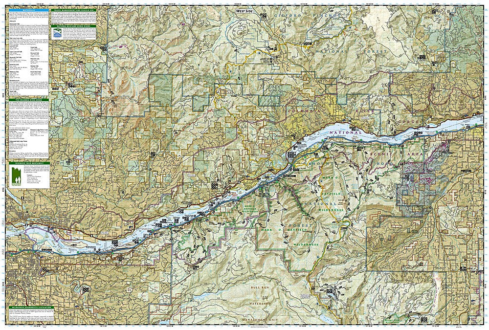
National Geographic Trails Illustrated Mount Hood & Columbia River Gorge Map Bundle — waterproof, tear-resistant, detailed topography, trail networks, climbing routes, waterfalls, and recreation areas across Oregon and Washington. Bundle #1020452.
The National Geographic Mount Hood & Columbia River Gorge Map Bundle includes two Trails Illustrated maps — Mt. Hood (trail networks, climbing routes, wilderness areas, ski resorts) and Columbia River Gorge (popular hiking trails, waterfalls, viewpoints, and recreation areas on both the Oregon and Washington sides). Detailed topography, campgrounds, scenic viewpoints, and boat launches on waterproof, tear-resistant paper.
Key specs
- SKU: NGTIB031
- Bundle number: 1020452
- Coverage: Mt. Hood, Oregon + Columbia River Gorge (OR/WA)
- Material: Waterproof, tear-resistant paper
- Features: Trail networks, climbing routes, waterfalls, viewpoints, campgrounds, boat launches
- Format: 2-map bundle
Why it works
Mount Hood and the Columbia River Gorge are two of the Pacific Northwest's most popular outdoor destinations, located within an hour of each other and frequently visited together. A bundle covering both areas in one purchase is more practical than buying individual maps and provides complete coverage for a Portland-area outdoor trip. The Columbia River Gorge map covers both the Oregon and Washington sides of the river, eliminating the need for separate state maps. Waterproof construction survives the Pacific Northwest's frequent rain.
Ideal for
Hikers, climbers, campers, and outdoor travelers exploring Mount Hood and the Columbia River Gorge. See also NGGM050 (Oregon Road Map) and NGGM076 (Washington Road Map) for broader regional access.
Share