National Geographic
Mount Baker & Boulder River Wilderness: Map #826
Mount Baker & Boulder River Wilderness: Map #826
Couldn't load pickup availability
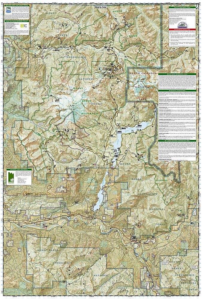
National Geographic Trails Illustrated Mount Baker & Boulder River Wilderness Map #826 — waterproof, tear-resistant. Coverage of Mount Baker, the Boulder River Wilderness, and surrounding Mount Baker-Snoqualmie National Forest in Washington. GPS-compatible.
The National Geographic Trails Illustrated Mount Baker & Boulder River Wilderness Map covers Mount Baker's glaciated volcanic cone, the Boulder River Wilderness, and surrounding national forest lands in the northern Washington Cascades. Trails, climbing routes, glacier approaches, wilderness boundaries, trailheads, and GPS coordinates are mapped in detail.
Key specs
- SKU: NGTI826
- Map number: 826
- Coverage: Mount Baker & Boulder River Wilderness, Washington
- Material: Waterproof, tear-resistant paper
- Features: Trails, Mount Baker climbing routes, glacier approaches, Boulder River Wilderness, trailheads, GPS coordinates
Why it works
Mount Baker is one of the most glaciated peaks in the contiguous US and a major mountaineering objective — accurate glacier approach and route detail is essential for climbers planning ascents of the Coleman, Easton, and other glaciated routes. The Boulder River Wilderness offers old-growth forest hiking in one of the most accessible wilderness areas from the Seattle area. Waterproof construction is critical in the North Cascades, where rain is among the heaviest in the continental US and glacier travel exposes maps to constant moisture.
Ideal for
Mountaineers, hikers, and wilderness lovers exploring Mount Baker's climbing routes and the Boulder River Wilderness in the northern Washington Cascades. See also NGTI827 (Glacier Peak Wilderness) for adjacent coverage to the south.
Share