National Geographic
Missoula & Mission Mountains: Map #724
Missoula & Mission Mountains: Map #724
Couldn't load pickup availability
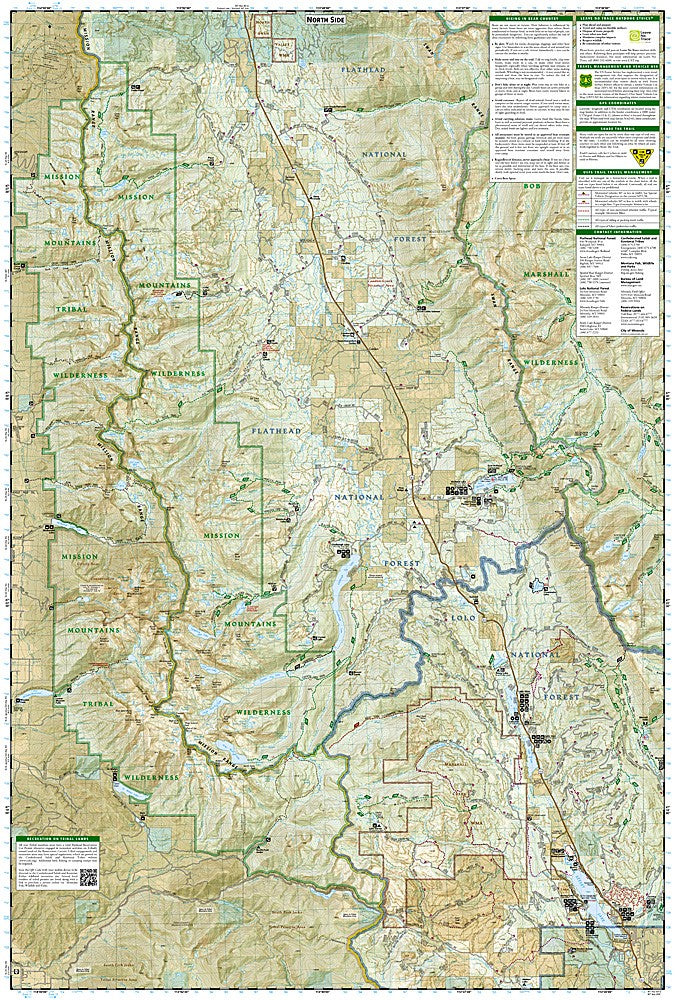
National Geographic Trails Illustrated Missoula & Mission Mountains Map #724 — waterproof, tear-resistant, scale 1:63,360. Coverage of the Mission Mountains Wilderness, Rattlesnake Wilderness, Flathead Lake, and surrounding Lolo and Flathead National Forests near Missoula, Montana. GPS-compatible.
The National Geographic Trails Illustrated Missoula & Mission Mountains Map covers the Mission Mountains Wilderness, the Rattlesnake Wilderness near Missoula, Flathead Lake, and surrounding national forest lands in western Montana. Trails, wilderness boundaries, lake access, trailheads, and GPS coordinates are mapped in detail.
Key specs
- SKU: NGTI724
- Map number: 724
- Scale: 1:63,360
- Coverage: Missoula & Mission Mountains area, Montana
- Material: Waterproof, tear-resistant paper
- Features: Trails, Mission Mountains Wilderness, Rattlesnake Wilderness, Flathead Lake, trailheads, GPS coordinates
Why it works
The Mission Mountains rise dramatically above Flathead Lake and the Mission Valley, offering some of the most scenic wilderness terrain in Montana within a relatively short drive of Missoula. The Rattlesnake Wilderness provides accessible backcountry recreation immediately adjacent to Missoula, making this map useful for both local day hikers and visitors planning longer wilderness trips. Waterproof construction survives western Montana's frequent rain and the stream crossings common in the Mission Mountains.
Ideal for
Hikers, backpackers, and anglers exploring the Mission Mountains Wilderness, Rattlesnake Wilderness, and Flathead Lake area near Missoula. See also NGTI725 (Bob Marshall Wilderness) for adjacent wilderness coverage to the east.
Share