National Geographic
Linville Gorge & Mount Mitchell: Map #779
Linville Gorge & Mount Mitchell: Map #779
Couldn't load pickup availability
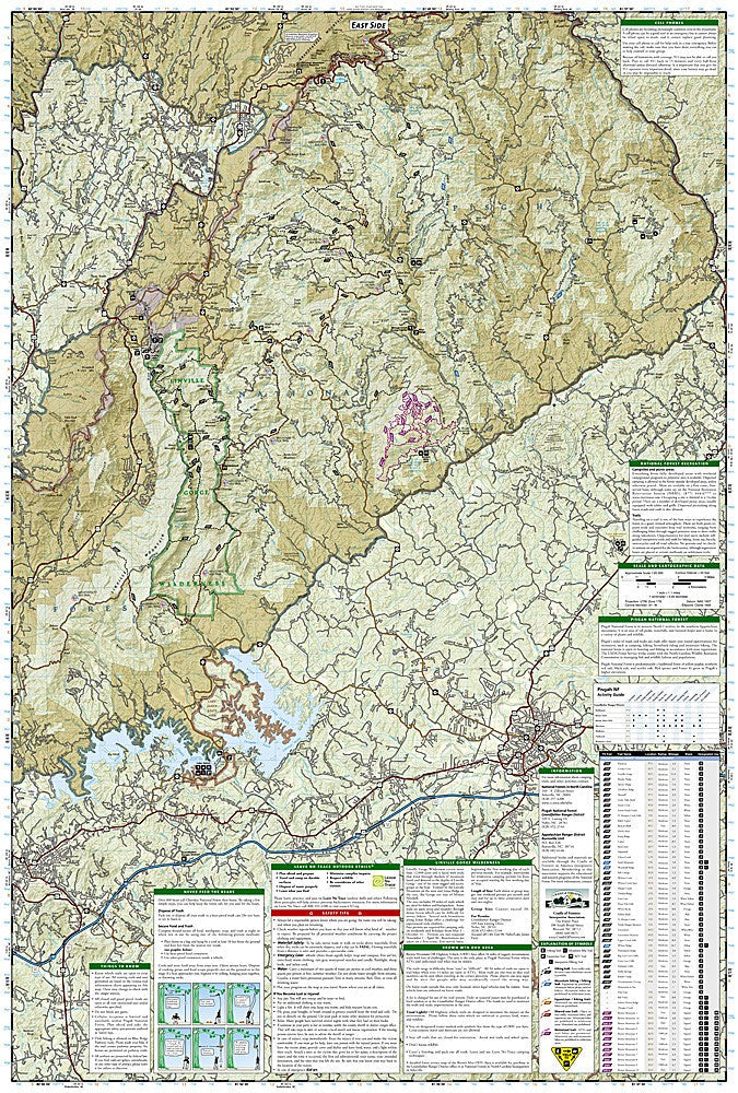
National Geographic Trails Illustrated Linville Gorge & Mount Mitchell Map #779 — waterproof, tear-resistant. Coverage of Linville Gorge Wilderness, Mount Mitchell State Park, Black Mountains, and surrounding Pisgah National Forest in North Carolina. GPS-compatible.
The National Geographic Trails Illustrated Linville Gorge & Mount Mitchell Map covers the Linville Gorge Wilderness — the deepest gorge in the eastern US — and Mount Mitchell, the highest peak east of the Mississippi River. Trails, wilderness boundaries, the Black Mountains ridge, trailheads, and GPS coordinates are mapped in detail.
Key specs
- SKU: NGTI779
- Map number: 779
- Coverage: Linville Gorge Wilderness & Mount Mitchell area, North Carolina
- Material: Waterproof, tear-resistant paper
- Features: Trails, Linville Gorge Wilderness, Black Mountains, Mount Mitchell, trailheads, GPS coordinates
Why it works
Linville Gorge is one of the most rugged and challenging wilderness areas in the eastern US — its steep walls, dense vegetation, and minimal trail maintenance make accurate topographic mapping essential for safe navigation. Mount Mitchell's summit at 6,684 feet is the highest point east of the Mississippi, attracting hikers who need accurate trail detail for the approach routes through the Black Mountains. Waterproof construction survives the frequent rain and fog common at high elevations in the southern Appalachians.
Ideal for
Hikers, backpackers, and climbers exploring Linville Gorge Wilderness and Mount Mitchell in the North Carolina Black Mountains. See also NGTI780 (Pisgah National Forest) for adjacent coverage to the southwest.
Share