National Geographic
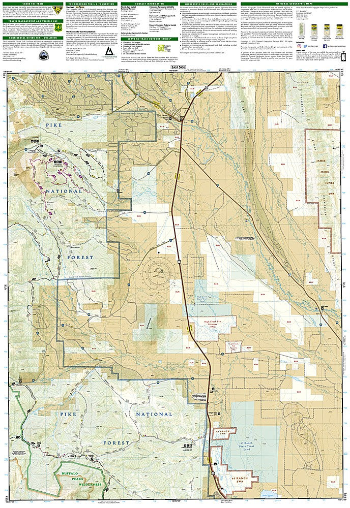
Leadville, Fairplay: Map #110
Leadville, Fairplay: Map #110
Couldn't load pickup availability
National Geographic Trails Illustrated Leadville & Fairplay Map #110 — waterproof, tear-resistant, scale 1:63,360. Coverage of the Mosquito Range, Mount Sherman, Mount Lincoln, Mount Democrat, Leadville, Fairplay, and surrounding Pike and San Isabel National Forests. GPS-compatible.
The National Geographic Trails Illustrated Leadville & Fairplay Map covers the Mosquito Range 14ers — Mount Sherman, Mount Lincoln, Mount Democrat, and Mount Bross — along with the historic mining towns of Leadville and Fairplay, 4WD roads, ghost towns, and surrounding national forest lands. Trails, 14er routes, 4WD tracks, trailheads, and GPS coordinates are mapped in detail.
Key specs
- SKU: NGTI110
- Map number: 110
- Scale: 1:63,360
- Coverage: Leadville & Fairplay area, Colorado (Mosquito Range)
- Material: Waterproof, tear-resistant paper
- Features: Trails, Mosquito Range 14er routes, 4WD roads, ghost towns, trailheads, GPS coordinates
Why it works
The Mosquito Range contains four 14ers that can be climbed in a single day from the same trailhead — accurate topo mapping is essential for navigating the ridge connections between summits safely. The 4WD road network accessing ghost towns and high-altitude mining sites adds significant value for off-road enthusiasts. Waterproof construction survives the afternoon thunderstorms that are a constant hazard on the Mosquito Range's exposed ridgelines.
Ideal for
Peak baggers, 4WD enthusiasts, and history buffs exploring the Mosquito Range 14ers, Leadville, and Fairplay. See also NGTI109 (Breckenridge, Tennessee Pass) for adjacent coverage to the north.
Share